CHCNAV CTS-A100 Android Manual Total Station | 2"
CHCNAV CTS-A100 Android Manual Total Station | 2" Availability status is shown on the product page when applicable.
Delivery and Shipping
Delivery and Shipping
Your order will be carefully processed and shipped as soon as possible. A tracking number will be sent via email and/or text once the shipping label is created. For more details, please view our 60-Day Return Policy.
Speak With An Expert
Speak With An Expert
Why Choose Absolute Accuracy
Why Choose Absolute Accuracy
Since 2008, we’ve been helping pros across Los Angeles get the right gear for the job. Our team’s got your back with certified, calibrated surveying and construction equipment you can count on. We offer quick shipping, solid support, and great prices on top brands. Shop with confidence. Everything we sell is tested, reliable, and ready to perform.

CHCNAV CTS-A100 Android Manual Total Station | 2"
Description
Description
User Guide
What’s Included
The CHCNAV CTS-A100 Total Station Kit – Part Number 4001 030 004 includes:
- 1× CHCNAV CTS-A100 Android Manual Total Station
- 1× Micro USB Cable
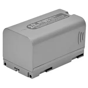
- 2× Li-50 801 Li-Ion Batteries
- 2× Li-30 C803 Li-Ion Battery Boxes
- 1× Li-Ion Battery Charger
- 1× British Standard Power Cable
- 1× EU Standard Power Cable
- 1× US Standard Power Cable
- 1× AU Standard Power Cable
- 1× Product Label
- 1× User Guide
- 1× Transport Case
- 2× Transport Case Liners
- 1× Transport Case Outer Carton
- 1× Transport Case Inner Carton
- 2× Carrying Case Straps
Overview
The CHCNAV CTS-A100 is a professional Android-powered manual total station designed for conventional surveying, construction layout, topographic mapping, boundary work, and engineering applications. It combines 2-second angular accuracy, a long-range reflectorless EDM, an integrated Android operating system, a large 5-inch HD touchscreen, and onboard CHCNAV LandStar software in one field-ready instrument.
Its EDM can measure up to 5,000 m with a prism and up to 1,500 m reflectorless, allowing crews to collect inaccessible or difficult points without requiring a prism at every target. A dual-axis electronic compensator helps maintain measurement stability, while the integrated digital electronic bubble simplifies instrument leveling.
Unlike conventional total stations that rely heavily on keypad-driven interfaces or an external data collector, the CTS-A100 uses an Android touchscreen interface with LandStar On Board, giving operators graphical project management, survey, stakeout, CAD, data import/export, prism configuration, and instrument settings directly on the total station. The user guide describes the Android interface as a way to improve operation speed and measurement efficiency.
Key Features
- 2" angular accuracy
- Up to 5,000 m measurement range with prism
- Up to 1,500 m reflectorless measurement range
- High-performance EDM
- Android operating system
- Integrated LandStar On Board survey software
- 5" HD touchscreen
- 1280 × 720 display resolution
- Qualcomm octa-core processor
- 3 GB RAM
- 32 GB internal storage
- High-performance CAD engine
- CAD-based survey and stakeout
- Dual-axis electronic compensator
- Digital electronic bubble
- Automated data collection
- Prism and reflectorless measurement
- Standard, Fast, and Tracking measurement modes
- Bluetooth connectivity
- Wi-Fi connectivity
- 3G/4G network capability
- USB and SD card support
- IP55 environmental protection
- Up to 8 hours of battery life
- Includes two batteries and transport case
2-Second Angular Accuracy
The CTS-A100 provides 2-second angular accuracy, making it suitable for a broad range of professional conventional surveying and construction applications.
Typical uses include:
- Boundary surveying
- Topographic surveys
- Construction layout
- Building surveys
- Control work
- As-built measurements
- Site development
- Utility layout
- General engineering surveys
CHCNAV lists 2" angular accuracy as one of the CTS-A100's core measurement specifications.
Long-Range Reflectorless EDM
The CTS-A100 incorporates a high-performance electronic distance measurement system capable of working with either prisms or directly against suitable surfaces.
Prism Measurement
With a compatible prism, the CTS-A100 provides a maximum measurement range of up to:
5,000 m
Reflectorless Measurement
Without a prism, the instrument can measure up to:
1,500 m
under suitable target and environmental conditions.
The extended reflectorless range is particularly useful when measuring:
- Building facades
- Structures
- Utility poles
- Walls
- Excavations
- Roadways
- Elevated points
- Unsafe or inaccessible locations
This can reduce the number of prism setups required and allow a single operator to collect certain measurements more efficiently.
Android Operating System
One of the biggest differences between the CTS-A100 and a traditional manual total station is its integrated Android operating system.
Rather than navigating through a basic monochrome display and nested instrument menus, operators work through a large touchscreen interface similar to an Android mobile device.
The CTS-A100 uses a Qualcomm octa-core processor with 3 GB of RAM and 32 GB of internal storage, providing the processing capability needed for onboard surveying, CAD viewing, project management, and data handling.
CHCNAV's manual specifically notes that the Android touchscreen system is intended to make instrument operation quicker and improve measurement efficiency.
5" HD Touchscreen
The CTS-A100 features a 5-inch HD touchscreen with a resolution of:
1280 × 720
The larger graphical interface allows operators to work directly with:
- Survey points
- Stakeout targets
- CAD drawings
- Project files
- Instrument settings
- Prism settings
- Station setup
- Maps
- Lines and arcs
CHCNAV also states that the display is designed to remain clear in bright field conditions.
LandStar On Board Survey Software
The CTS-A100 comes with CHCNAV LandStar On Board, a full-featured survey application specifically designed for intelligent Android total stations.
LandStar On Board integrates project management, conventional surveying, stakeout, CAD functionality, instrument controls, and data management directly into the CTS-A100.
The software is organized around straightforward field workflows and includes dedicated functions for:
- Station setup
- Surveying
- Point stakeout
- Line stakeout
- Project management
- Point management
- Line and arc management
- CAD map management
- Data import
- Data export
- Prism setup
- Instrument configuration
CAD-Based Survey and Stakeout
LandStar On Board includes a high-performance CAD engine that allows design drawings to be brought directly into the field.
Users can import DWG and DXF files, display them directly on the total station, and select points or lines from the drawing for field operations.
CHCNAV states that its CAD engine is capable of smoothly browsing CAD base maps as large as approximately 200 MB.
This can simplify construction layout because operators can visually work from the project drawing instead of manually entering every coordinate before going into the field.
Station Setup Options
LandStar On Board provides several common methods for establishing the total station position and orientation.
Available station setup methods include:
- Resection / Free Station
- Backsight to Known Point
- Backsight by Azimuth
The software can also be used to:
- Check station orientation
- Change instrument height
- Reset elevation
- Determine station elevation from a known point
This gives field crews flexibility when setting up over known control or establishing the instrument from surrounding control points.
Point and Line Stakeout
The CTS-A100 provides graphical point and line stakeout directly through LandStar On Board.
For point stakeout, the display can provide information such as:
- Direction to target
- Stake distance
- Cut / fill
- Design elevation
- Northing difference
- Easting difference
- Elevation difference
- Horizontal and vertical angles
For line stakeout, operators can work with:
- Station
- Offset
- Cut / fill
- Ahead / back
- Inward / outward
- Horizontal offset
- Vertical offset
The software allows point and line targets to be selected directly from the graphical view or from the project's point and line databases.
Advanced Dual-Axis Compensation
The CTS-A100 includes a dual-axis electronic compensator designed to help maintain measurement accuracy when small leveling deviations are present.
The instrument also incorporates an electronic bubble for setup and leveling. Operators can view compensation values for the X and Y axes directly through the instrument interface and select either single-axis or dual-axis compensation modes.
CHCNAV highlights this system as a way to improve measurement stability on uneven terrain.
Standard, Fast, and Tracking Measurement Modes
The CTS-A100 provides several EDM measurement modes depending on the job.
Available modes include:
- Standard
- Fast
- Track
Fast mode is designed to return measurement data more quickly, while Tracking mode allows continuous measurements during stakeout and other dynamic field operations.
Automated Data Collection
The CTS-A100 is designed to automatically record measurement and coordinate data during fieldwork.
The instrument supports onboard storage and digital transfer of survey information, helping reduce manual transcription between field and office workflows.
LandStar On Board also provides dedicated project, point, line, layer, import, and export management.
Data Import and Export
LandStar On Board supports several common survey and CAD formats.
Point Data Import / Export
Supported formats include:
- TXT
- CSV
- DAT
- XLS
- XLSX
Custom import and export arrangements can also be configured.
CAD Import
- DWG
- DXF
CAD Export
- AutoCAD DXF 2007
- AutoCAD DWG 2007
This makes it easier to move coordinate and design information between the field instrument and office software.
Bluetooth, Wi-Fi, and Mobile Network Connectivity
The Android platform gives the CTS-A100 several options for data communication.
The user guide documents support for:
- Bluetooth
- Wi-Fi
- 3G / 4G network connectivity
- USB connection
- SD memory card
- USB flash drives
Bluetooth can also be used to communicate with compatible external field devices, while Wi-Fi and cellular connectivity can support field-to-office data transfer and software updates.
Field Calculations and Survey Methods
In addition to direct measurements, LandStar On Board provides several survey methods for specialized field observations.
Available methods include:
- Direct Measure
- F1 / F2
- Offset HA
- Offset VA
- Offset Distance
F1/F2 observations can use averaged direct and reverse measurements, while the offset functions calculate inaccessible point coordinates using horizontal angle, vertical angle, or distance offsets.
Dual 5,000 mAh Battery System
The CTS-A100 kit includes two Li-ion batteries, allowing one battery to be used while the other remains charged as a spare.
CHCNAV's user guide specifies a standard battery capacity of 5,000 mAh, while the manufacturer lists total station operating time of up to approximately 8 hours depending on measurement mode and field conditions.
Battery consumption can vary because EDM distance measurement requires more power than angle-only observation.
Rugged IP55 Design
The CTS-A100 is built for daily professional field use and carries an IP55 protection rating.
This provides protection against dust and water exposure commonly encountered on construction and survey sites. CHCNAV specifies an operating temperature range of:
-20°C to +50°C (-4°F to +122°F).
Ideal Applications
The CHCNAV CTS-A100 is well suited for:
- Boundary surveying
- Topographic surveying
- Construction layout
- Building surveys
- Site development
- As-built surveying
- Utility surveys
- Road and infrastructure projects
- Coordinate collection
- Point stakeout
- Line stakeout
- CAD-based construction layout
- Control surveys
- Conventional total station surveying
- Engineering measurement
Technical Specifications
Angular Accuracy: 2"
Distance Measurement
- With Prism: Up to 5,000 m
- Reflectorless: Up to 1,500 m
Operating System: Android
Processor: Qualcomm octa-core
Memory
- RAM: 3 GB
- Internal Storage: 32 GB
Display
- Size: 5"
- Resolution: 1280 × 720
- Touchscreen interface
Compensator
- Dual-axis electronic compensation
- Electronic bubble
Measurement Modes
- Standard
- Fast
- Track
Onboard Software: CHCNAV LandStar On Board
CAD Support
- DWG
- DXF
- CAD-based survey and stakeout
Data Formats
- TXT
- CSV
- DAT
- XLS
- XLSX
- DWG
- DXF
Connectivity
- Bluetooth
- Wi-Fi
- 3G / 4G
- USB
- SD card support
Battery
- 5,000 mAh Li-ion
- Two batteries included
- Up to 8 hours operation
Environmental Protection: IP55
Operating Temperature: -20°C to +50°C (-4°F to +122°F)
Dimensions: 195 × 185 × 365 mm
Weight: 5.5 kg
Android Total Station for Modern Conventional Surveying
The CHCNAV CTS-A100 combines the accuracy and workflow of a professional manual total station with the convenience of an Android touchscreen and integrated LandStar survey software. Its 2-second accuracy, 5,000 m prism range, 1,500 m reflectorless EDM, CAD-based stakeout, dual-axis compensation, and onboard project management make it a versatile solution for everyday surveying and construction layout.
For crews that prefer conventional total station measurements but want a more modern graphical field interface without relying entirely on a separate data collector, the CTS-A100 provides a streamlined field-to-office workflow with surveying, stakeout, CAD, and data management directly onboard the instrument.
Payment & Security
Payment methods
Your payment information is processed securely. We do not store credit card details nor have access to your credit card information.