Carlson SurvPC Field Software
Carlson SurvPC Field Software - Total Station is backordered and will ship as soon as it is back in stock.
Delivery and Shipping
Delivery and Shipping
Your order will be carefully processed and shipped as soon as possible. A tracking number will be sent via email and/or text once the shipping label is created. For more details, please view our 60-Day Return Policy.
Speak With An Expert
Speak With An Expert
Why Choose Absolute Accuracy
Why Choose Absolute Accuracy
Since 2008, we’ve been helping pros across Los Angeles get the right gear for the job. Our team’s got your back with certified, calibrated surveying and construction equipment you can count on. We offer quick shipping, solid support, and great prices on top brands. Shop with confidence. Everything we sell is tested, reliable, and ready to perform.
All Instruments Will Ship Calibrated
Certification Provided For Optical & Lasers
Description
Description
, Carlson SurvPC brings the power and versatility of Carlson’s field-proven data collection software to full Windows tablets and PCs. Designed for surveyors, engineers, and GIS professionals who prefer a larger display and greater computing power, SurvPC runs on Windows 10/11 devices and provides a seamless, high-performance platform for total station, GNSS, and hybrid workflows.
Built with the same user interface as SurvCE, SurvPC is ideal for users who want a consistent experience across handheld data collectors and rugged tablets. It offers wide-ranging instrument support, advanced road and coordinate geometry tools, real-time linework, GIS data collection, and complete integration with Carlson Office and CAD products.
Key Features:
- Runs on Windows 10/11 Tablets & PCs – Use on rugged field tablets or laptops for full-screen control and visibility
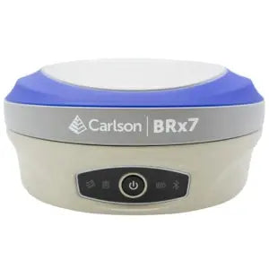
- Complete Instrument Support – Compatible with GNSS receivers like the Carlson BRx7 and Stonex S999, as well as total stations like the Nikon XF HP 1", Sokkia iX-1500/700, and GeoMax Zoom95
- Hybrid+ Capability – Combine GNSS and robotic total station data collection in a single, integrated workflow
- Real-Time Linework – Create and visualize linework as you survey, with Smart AutoMap and feature coding
- Advanced COGO & Road Tools – Full suite of coordinate geometry functions, road alignments, and staking features
- GIS Module Available – Collect attribute-rich GIS data in the field and export to SHP, KML, and more
- Office Integration – Seamlessly integrates with Carlson Survey, Civil, and other CAD software for smooth field-to-finish workflows
- Multiple Language Support – Available in over two dozen languages for global field teams
Payment & Security
Payment methods
Your payment information is processed securely. We do not store credit card details nor have access to your credit card information.


