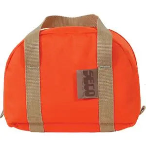
CHCNAV HCE620 Handheld Data Collector Tablet
CHCNAV HCE620 Handheld Data Collector Tablet - None Availability status is shown on the product page when applicable.
Delivery and Shipping
Delivery and Shipping
Your order will be carefully processed and shipped as soon as possible. A tracking number will be sent via email and/or text once the shipping label is created. For more details, please view our 60-Day Return Policy.
Speak With An Expert
Speak With An Expert
Why Choose Absolute Accuracy
Why Choose Absolute Accuracy
Since 2008, we’ve been helping pros across Los Angeles get the right gear for the job. Our team’s got your back with certified, calibrated surveying and construction equipment you can count on. We offer quick shipping, solid support, and great prices on top brands. Shop with confidence. Everything we sell is tested, reliable, and ready to perform.

CHCNAV HCE620 Handheld Data Collector Tablet
Description
Description
Data Sheet - Training Videos
What’s Included
The CHCNAV HCE620 Handheld Data Collector Kit – Part Number 8001 010 442 includes:
- 1× 4001 040 034 – CHCNAV HCE620 Handheld GNSS Data Collector, QWERTY
- 1× 4103 010 096 – USB Type-C Cable
- 1× 4104 060 069 – 5 V / 2.4 A Power Adapter
- 1× 0103 020 320 – Android Stylus
- 1× 4102 080 007 – Non-Magnetic Controller Bracket
- 1× 4106 040 171 – Controller Case
- 1× 4106 080 174 – Controller Case Foam Liner
- 1× 4106 080 175 – Controller Case Foam Cover
- 1× 0106 990 001 – Outer Carton Label
- 1× 1906 210 639 – LandStar 8 Data Collection Software for Android
Optional:
- 4109020227 – LandStar 8 Data Collection Software (Android) GNSS License
- 4109020219 – LandStar 8 Data Collection Software (Android) Total Station License
- 4109020220 – LandStar 8 Data Collection Software (Android) GNSS + Total Station License
Overview
The CHCNAV HCE620 is a rugged Android handheld data collector designed specifically for surveying, mapping, construction layout, and GNSS field work. It combines a 5.45-inch sunlight-readable touchscreen, full backlit QWERTY keyboard, 4G LTE, dual-band Wi-Fi, Bluetooth 5.0, NFC, and a large 9,000 mAh battery in a compact controller weighing only 401 g (14.1 oz).
Designed as a dedicated field controller rather than a general-purpose consumer smartphone, the HCE620 provides physical number keys, directional controls, programmable buttons, and a QWERTY keyboard for fast point naming, coding, and survey data entry. Its rugged IP68 housing and 1.5 m drop resistance make it suitable for daily use on survey and construction sites.
This kit also includes CHCNAV LandStar 8 Data Collection Software for Android, making it a complete field controller package for compatible CHCNAV GNSS receivers and survey workflows.
Key Features
- 5.45" HD+ touchscreen
- 1440 × 720 resolution
- 500-nit display brightness
- Full backlit QWERTY keyboard
- Dedicated 10-key number pad
- Directional and programmable buttons
- Android 11 operating system
- Helio MTK6762 octa-core 2.0 GHz processor
- 4 GB RAM
- 64 GB internal storage
- MicroSD expansion up to 128 GB
- Built-in 4G LTE modem
- Dual-band 2.4 GHz / 5 GHz Wi-Fi
- Bluetooth 5.0
- NFC
- USB Type-C with OTG
- 9,000 mAh battery
- 20+ hour operating time
- IP68 dust and water protection
- Survives a 1.5 m drop onto concrete
- 13 MP rear camera
- Integrated high-output flashlight
- Built-in GNSS for general positioning
- 9-axis compass and gyro fusion
- Includes LandStar 8
- Includes non-magnetic pole/controller bracket
Full QWERTY Keyboard for Survey Work
One of the HCE620's biggest advantages over a standard tablet or smartphone is its integrated physical keyboard.
The controller includes:
- Full QWERTY keyboard
- 10-key numeric keypad
- Directional buttons
- Programmable buttons
- White backlighting
This layout is especially useful for survey crews who frequently enter:
- Point numbers
- Feature codes
- Descriptions
- Station values
- Offsets
- Heights
- Numeric measurements
CHCNAV specifically designed the keyboard to improve data entry efficiency without requiring users to rely entirely on an on-screen keyboard.
5.45" Sunlight-Readable Display
The HCE620 uses a 5.45-inch IPS LTPS touchscreen with:
- 1440 × 720 HD+ resolution
- 295 ppi
- 500 cd/m² brightness
- Capacitive multi-touch
The screen is large enough to display CAD drawings, maps, stakeout information, and LandStar project data while keeping the controller compact enough for one-handed field use.
This gives the HCE620 a middle ground between a traditional small-screen survey controller and a larger tablet.
LandStar 8 Data Collection Software
This kit includes CHCNAV LandStar 8 Data Collection Software for Android – Part Number 1906 210 639.
LandStar is CHCNAV's professional field data collection platform for GNSS surveying, construction layout, mapping, engineering, and related applications.
Depending on licensing and connected instruments, LandStar supports:
- GNSS RTK surveying
- NTRIP / CORS connections
- UHF base and rover workflows
- Point collection
- Control surveys
- Continuous survey
- Point stakeout
- Line stakeout
- CAD stakeout
- Surface stakeout
- Road stakeout
- Coordinate systems
- Site calibration
- Code libraries
- Import and export
- Project management
- Surfaces and volumes
- Cloud data sharing
The HCE620 datasheet identifies LandStar as the controller's primary field-survey application and notes that the platform supports cloud services and remote assistance.
Designed for CHCNAV GNSS Receivers
The HCE620 is designed to connect with compatible CHCNAV GNSS receivers and serve as the primary field interface.
It is well suited for receivers such as:
- CHCNAV i76
- CHCNAV i83
- CHCNAV i85
- CHCNAV i89
- CHCNAV i93
- CHCNAV ViLi i100
- CHCNAV iBase systems
Through LandStar, the controller can be used to configure receivers, manage correction sources, collect survey points, perform stakeout, and manage project data.
4G LTE Connectivity
The HCE620 includes a built-in global 4G cellular modem with Nano-SIM support.
This allows the controller to connect directly to:
- NTRIP / CORS correction networks
- Cloud storage
- CHCNAV cloud services
- Web services
- Remote support
This is particularly useful for RTK surveying because the data collector can provide the network connection needed for correction services without relying on a separate mobile hotspot.
Dual-Band Wi-Fi, Bluetooth 5.0, and NFC
The controller supports:
- Wi-Fi 802.11 a/b/g/n/ac
- 2.4 GHz and 5 GHz Wi-Fi
- Bluetooth 5.0
- NFC
- USB Type-C / OTG
Bluetooth provides wireless communication with compatible GNSS receivers, while dual-band Wi-Fi allows faster access to project files, cloud services, and local networks.
20+ Hour Battery Life
The HCE620 incorporates a large 9,000 mAh lithium-ion battery.
CHCNAV specifies:
- 20+ hours operating time
- Approximately 4 hours charging time
under its stated test conditions.
This extended runtime is a major advantage for field crews working long survey days where recharging may not be convenient.
Rugged IP68 Construction
The HCE620 is designed for demanding field environments.
Durability specifications include:
- IP68 dust and water protection
- 1.5 m drop resistance onto concrete
- Operating temperature from -30°C to +60°C (-22°F to +140°F)
- Storage temperature from -40°C to +70°C (-40°F to +158°F)
- 5%–95% non-condensing humidity tolerance
This makes it suitable for survey, construction, utility, and mapping crews working in rain, dust, heat, cold, and rough jobsite conditions.
9-Axis Compass and Gyro Fusion
The HCE620 includes an integrated electronic compass and gyro system.
CHCNAV states that its nine-axis compass and gyro fusion algorithm is designed to reduce the effects of magnetic interference and provide more reliable heading information.
This can improve field navigation and RTK stakeout workflows where the controller's heading is used to orient graphical guidance.
Built-In GNSS
The HCE620 includes an internal 45-channel GNSS receiver for general location and navigation.
Supported signals include:
- GPS L1C/A
- GLONASS L1
- BeiDou B1
- Galileo E1
- A-GPS
Autonomous horizontal accuracy is specified at approximately 2–5 m HRMS.
This internal GNSS is intended primarily for general positioning and navigation. For centimeter-level survey work, the HCE620 is normally paired with an external survey-grade GNSS receiver.
13 MP Camera and High-Output Flashlight
The HCE620 includes:
- 13 MP rear camera
- Auto-focus
- Flash
- Professional high-output flashlight
The camera can be used for site documentation, asset records, GIS attributes, and field photos associated with survey work.
Non-Magnetic Controller Bracket Included
This kit includes the CHCNAV 4102 080 007 non-magnetic controller bracket, allowing the HCE620 to be mounted directly to a survey range pole.
The non-magnetic design is especially useful when working with GNSS receivers using IMU and heading-sensitive workflows, helping reduce unnecessary magnetic material near the pole setup.
Absolute Accuracy Dealer Support
When you purchase your CHCNAV HCE620 from Absolute Accuracy, you have access to dealer support from a team familiar with CHCNAV GNSS hardware and LandStar field workflows.
If needed, we can help with:
- Initial HCE620 setup
- LandStar installation and configuration
- Connecting the controller to compatible CHCNAV GNSS receivers
- NTRIP / CORS setup
- UHF base and rover configuration
- Coordinate system setup
- Basic survey and stakeout workflows
- Troubleshooting and general product training
For customers moving to CHCNAV from another survey platform, setup assistance and training are available to help make the transition easier and get crews working in the field faster.
Ideal Applications
The CHCNAV HCE620 is well suited for:
- GNSS RTK surveying
- Construction layout
- Boundary surveying
- Topographic surveying
- Utility mapping
- Site development
- Road and infrastructure work
- As-built surveys
- Cadastral surveying
- Point and line stakeout
- CAD-based layout
- NTRIP / CORS surveying
- UHF RTK workflows
- GIS data collection
- Field mapping
- Survey coding and attribute entry
Technical Specifications
Operating System: Android 11
Processor: Helio MTK6762 Octa-Core, 2.0 GHz
Memory
- RAM: 4 GB
- Internal Storage: 64 GB
- MicroSDHC: Up to 128 GB
Display
- Size: 5.45"
- Resolution: 1440 × 720
- Density: 295 ppi
- Brightness: 500 cd/m²
- IPS LTPS capacitive multi-touch
Keyboard
- Full QWERTY
- 10-key number pad
- Directional buttons
- Programmable buttons
- White backlight
Cellular
- Nano-SIM
- 4G LTE
- WCDMA
- GSM
Wireless
- Wi-Fi 802.11 a/b/g/n/ac
- 2.4 GHz / 5 GHz
- Bluetooth 5.0
- NFC
USB: Type-C, OTG supported
Internal GNSS
- 45 channels
- GPS L1C/A
- GLONASS L1
- BeiDou B1
- Galileo E1
- A-GPS
- Autonomous accuracy: 2–5 m HRMS
Battery: 9,000 mAh lithium-ion
Operating Time: 20+ hours
Charging Time: Approximately 4 hours
Camera
- 13 MP rear
- Auto-focus
- Flash
Sensors
- G-Sensor
- E-Compass
- Light sensor
- Gyro / heading fusion
Protection: IP68
Drop Rating: 1.5 m onto concrete
Operating Temperature: -30°C to +60°C (-22°F to +140°F)
Storage Temperature: -40°C to +70°C (-40°F to +158°F)
Dimensions: 221 × 78 × 16.5 mm (8.7 × 3.0 × 0.6 in)
Weight: 401 g with battery
Rugged QWERTY Controller for Professional Surveying
The CHCNAV HCE620 combines the portability of a handheld Android device with the physical controls and durability expected from a dedicated survey data collector. Its full QWERTY keyboard, 20+ hour battery life, IP68 protection, 4G LTE, dual-band Wi-Fi, Bluetooth 5.0, and included LandStar 8 software make it an excellent field controller for CHCNAV GNSS systems and everyday surveying applications.
Payment & Security
Payment methods
Your payment information is processed securely. We do not store credit card details nor have access to your credit card information.