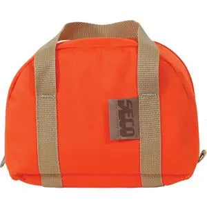
CHCNAV AlphaAir 15 LiDAR System with C5 Camera
CHCNAV AlphaAir 15 LiDAR System with C5 Camera Availability status is shown on the product page when applicable.
Delivery and Shipping
Delivery and Shipping
Your order will be carefully processed and shipped as soon as possible. A tracking number will be sent via email and/or text once the shipping label is created. For more details, please view our 60-Day Return Policy.
Speak With An Expert
Speak With An Expert
Why Choose Absolute Accuracy
Why Choose Absolute Accuracy
Since 2008, we’ve been helping pros across Los Angeles get the right gear for the job. Our team’s got your back with certified, calibrated surveying and construction equipment you can count on. We offer quick shipping, solid support, and great prices on top brands. Shop with confidence. Everything we sell is tested, reliable, and ready to perform.

CHCNAV AlphaAir 15 LiDAR System with C5 Camera
Description
Description
CHCNAV AlphaAir 15: Airborne LiDAR with full-frame imagery
The CHCNAV AlphaAir 15 (AA15) combines aerial laser scanning with a dedicated camera package for surveyors who need terrain data and detailed imagery from the same project. This configuration includes the 45 MP full-frame C5 camera with a 21 mm lens. It is a strong candidate for firms doing repeat corridor surveys, infrastructure mapping and larger topographic projects where both the point cloud and photographic record matter.
For a survey crew, the decision starts with the deliverable. Bare-earth surfaces require usable ground observations and careful classification. Utility and transportation projects need sufficient sampling of narrow features and changes in elevation. The AA15 offers a high acquisition rate and multiple returns to support those tasks, while the C5 adds imagery for interpreting features and colorizing compatible point clouds.
Where the AA15 fits your surveying work
- Topographic and land-development surveys: collect broad site coverage for surface preparation, breakline interpretation and downstream contour generation. Plan independent checkpoints to assess the finished surface.
- Road, rail and utility corridors: use repeated flight lines to document terrain and visible infrastructure along a route. Set speed, overlap and scan settings around the smallest feature your deliverable must resolve.
- Vegetated sites: multiple returns can record canopy and lower surfaces where pulses reach them. Ground visibility still depends on vegetation, season and collection geometry.
- Urban and infrastructure documentation: combine laser geometry and full-frame imagery when visual context helps the office team distinguish structures and site features.
| Specification | Detail |
|---|---|
| Maximum pulse rate | Up to 2,000,000 pulses/second |
| Laser field of view | 75° |
| Returns | Up to 16 per pulse |
| Scan speed | Up to 600 lines/second |
| Imaging in this package | 45 MP full-frame C5 camera; 21 mm lens |
| Environmental protection | IP64 |
| Package MPN | 8005010114 |
These are manufacturer specifications, not a guarantee of final survey accuracy. Pulse rate, range, flight height, speed, target reflectivity, positioning quality and control all influence the result. Choose acquisition settings from the required ground sampling and deliverable tolerance.
AA15 vs. other CHCNAV LiDAR options
| System | Why choose it | Main buying consideration |
|---|---|---|
| AlphaAir 450 | Lower-cost entry into aerial LiDAR with integrated 26 MP imaging | Best evaluated against your required coverage, vegetation and project detail. |
| AlphaAir 6 | Lightweight integrated LiDAR and imaging for routine aerial survey work | Compare payload weight and camera format with the AA15/C5 configuration. |
| AlphaAir 15 with C5 | Dedicated aerial survey package with a full-frame 45 MP camera | A good shortlist when imagery quality and repeat production work justify this configuration. |
| AlphaUni 20 | A system that can move between airborne and vehicle mapping configurations | Consider AU20 when road-level capture is an actual service requirement. |
What is included
- AA15 LiDAR unit, P/N S20415021600004001.
- C5 camera with 21 mm lens, P/N S39905000024202001.
- Transport container, USB 3.0 to Type-C adapter cable, SD/TF card reader and 32 GB USB drive.
- Lens-cleaning blower and user manual.
Aircraft, flight batteries and processing licenses are selected separately. Review the CHCNAV X500 mapping drone packages for a complete flight setup. Confirm the payload interface, total installed weight and camera integration for the aircraft you intend to use.
From flight data to finished survey
CHCNAV CoPre handles supported raw-data and trajectory processing; CoProcess provides downstream point-cloud tools. Select Professional when the Terrain module is required. Add an appropriate modeling license if the contract calls for textured 3D models as well as survey data.
Absolute Accuracy support and training
Talk with Absolute Accuracy about your terrain, vegetation, expected daily coverage and final CAD or surface deliverables. We can help you evaluate the payload configuration and discuss training for mission planning, control, processing and quality review. Ask for a scope that matches your crew’s experience and the software you already use.
Payment & Security
Payment methods
Your payment information is processed securely. We do not store credit card details nor have access to your credit card information.