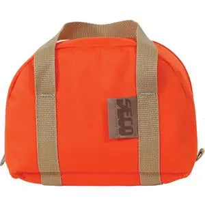
Leica GS05 GNSS Receiver
Leica GS05 GNSS Receiver - UHF Rover Kit Availability status is shown on the product page when applicable.
Delivery and Shipping
Delivery and Shipping
Your order will be carefully processed and shipped as soon as possible. A tracking number will be sent via email and/or text once the shipping label is created. For more details, please view our 60-Day Return Policy.
Speak With An Expert
Speak With An Expert
Why Choose Absolute Accuracy
Why Choose Absolute Accuracy
Since 2008, we’ve been helping pros across Los Angeles get the right gear for the job. Our team’s got your back with certified, calibrated surveying and construction equipment you can count on. We offer quick shipping, solid support, and great prices on top brands. Shop with confidence. Everything we sell is tested, reliable, and ready to perform.

Leica GS05 GNSS Receiver
Description
Description
Data Sheet | White Paper
What’s Included
UHF Rover Kit
Receives UHF RTK corrections from a compatible base station.
- 1 × Leica GS05 UHF Rover (p/n 1003096)
- 1 × GS05 Tilt Compensation option (p/n 1006940)
- 1 × GVP753 GNSS Rover Container (p/n 980902)
- 1 × GEV302 30 W USB-C AC/DC Adapter (p/n 983714)
- 1 × GEV278 1 m USB-C Cable (p/n 879634)
- 1 × Leica GS05 Multilingual Quick Guide (p/n 989238)
LTE Network Rover Kit
Connects to a compatible network RTK service through the receiver’s built-in 4G LTE modem.
- 1 × Leica GS05 LTE Rover (p/n 949991)
- 1 × GS05 Tilt Compensation option (p/n 1006940)
- 1 × GVP753 GNSS Rover Container (p/n 980902)
- 1 × GEV302 30 W USB-C AC/DC Adapter (p/n 983714)
- 1 × GEV278 1 m USB-C Cable (p/n 879634)
- 1 × Leica GS05 Multilingual Quick Guide (p/n 989238)
LTE Network Rover Kit + 1 Year SmartNet
Uses the built-in 4G LTE modem to receive HxGN SmartNet network RTK corrections where service is available.
- 1 × Leica GS05 LTE SmartNet Rover (p/n 949992)
- 1 × SmartNet NRTK GS05 1 yr (p/n 5312575)
- 1 × GS05 Tilt Compensation option (p/n 1006940)
- 1 × GVP753 GNSS Rover Container (p/n 980902)
- 1 × GEV302 30 W USB-C AC/DC Adapter (p/n 983714)
- 1 × GEV278 1 m USB-C Cable (p/n 879634)
- 1 × Leica GS05 Multilingual Quick Guide (p/n 989238)
UHF Base Kit
Transmits local RTK corrections to a compatible UHF rover.
- 1 × Leica GS05 UHF Base (p/n 1003097)
- 1 × GVP752 GNSS Base Container (p/n 980901)
- 1 × GEV302 30 W USB-C AC/DC Adapter (p/n 983714)
- 1 × GEV278 1 m USB-C Cable (p/n 879634)
- 1 × Leica GS05 Multilingual Quick Guide (p/n 989238)
UHF Base & Rover Kit
Pairs a GS05 UHF base and a GS05 UHF rover for local RTK surveying with your own correction source.
- 1 × Leica GS05 UHF Base (p/n 1003097)
- 1 × Leica GS05 UHF Rover (p/n 1003096)
- 1 × GS05 Tilt Compensation option for the rover (p/n 1006940)
- 1 × GVP754 GNSS Base+Rover Container (p/n 980903)
- 2 × GEV302 30 W USB-C AC/DC Adapter (p/n 983714)
- 2 × GEV278 1 m USB-C Cable (p/n 879634)
- 2 × Leica GS05 Multilingual Quick Guide (p/n 989238)
Field controllers, Leica Captivate software, survey poles and base mounting accessories are sold separately. LTE network RTK requires cellular data and correction service coverage.
Overview
The Leica GS05 GNSS Receiver is a compact real-time kinematic (RTK) smart antenna for land surveying, construction layout, topographic mapping and as-built data collection. At 0.75 kg (1.65 lb) with the battery installed, it keeps the survey pole easier to carry and handle through a full day on site. Choose a UHF rover, dedicated UHF base, matched base and rover pair, or LTE network rover, including a kit with one year of HxGN SmartNet.
The 184-channel receiver tracks GPS, GLONASS, Galileo, BeiDou and QZSS. Leica RTKplus adapts satellite selection as conditions change, and Leica SmartCheck continuously checks the RTK solution. The GS05 supports Leica Captivate for survey and CAD stakeout and Leica X-PAD on compatible Android field hardware.
Key Features
- Centimeter-class RTK positioning for local base and rover or network RTK workflows under favorable conditions.
- Calibration-free 30° IMU tilt compensation with the activation included in the rover kits.
- Configuration-specific correction links with UHF radio or built-in 4G LTE, depending on the kit.
- Internal 6,000 mAh battery and USB-C charging with typical runtime up to 10 hours, depending on the operating mode and conditions.
- IP66 and IP68 housing with a 5/8-inch threaded mount for compatible GNSS poles and base adapters.
Augmented Reality Guidance with Leica X-PAD
For crews looking for AR stakeout guidance, Leica X-PAD can use the camera on a supported Android field controller or tablet together with the GS05 rover’s IMU. After the operator sets the camera-to-antenna offsets in X-PAD, the AR view can overlay CAD geometry on the live site image to help the crew orient itself and approach the point. The controller supplies the imagery, and the GS05 supplies the positioning and tilt data used to locate the pole tip.
This setup requires compatible Leica X-PAD software, an activated GS05 rover IMU and a camera-equipped Android device mounted to the pole. Follow Leica’s camera alignment procedure when setting up the controller or changing its mounting position.
Leica X-PAD augmented reality setup guide
30° Tilt Compensation for Surveying and Stakeout
The GS05 combines GNSS and IMU data to calculate the pole-tip position while the pole is tilted. Keep the tip on the survey point and move the receiver away from a fence, wall or parked equipment where holding the pole plumb would be awkward. The same workflow is useful when staking curb returns, picking up utility lids, or recording points along the edge of a trench.
The rover kits include the Leica tilt compensation activation (p/n 1006940). Leica specifies less than 15 mm of additional horizontal uncertainty through 30° of tilt. For static control observations, set the receiver over the mark and use the appropriate static observation workflow.
UHF Base and Rover or LTE Network RTK
- Local UHF RTK. Set the GS05 base over a known or established point and broadcast corrections directly to a compatible rover. The combined kit is suited to sites where a crew wants its own correction source or works beyond cellular coverage. The built-in radio operates at 413–473 MHz, with RTCM 3.2 MSM over UHF. Leica cites a typical line-of-sight range of up to 1.5 km (about 0.9 mile). Terrain, buildings and radio interference affect practical range.
- LTE network RTK. Connect the standard LTE Network Rover to a compatible correction service through its built-in 4G LTE modem. This is useful for crews moving between jobs in an area with cellular data and correction network coverage.
- HxGN SmartNet network RTK. The SmartNet kit includes one year of network corrections for the GS05 through SmartNet Sensor ID authentication. Choose the standard LTE Network Rover if your workflow relies on a different correction provider. Leica offers a separate RTK Rover activation (p/n 1006935) for the SmartNet-specific receiver to use other compatible corrections.
Leica Captivate, CAD Stakeout and SmartPole
Use Leica Captivate Measure & Stakeout to collect coded survey points, review geometry in the 3D viewer and navigate to design points with graphical guidance. Depending on the installed Captivate apps, crews can also work from CAD or IFC design data, stake lines and offsets, and check differences between measured and design positions.
For mixed GNSS and robotic total station work, mount the receiver above a compatible 360° prism in a Leica SmartPole setup. Take GNSS observations in open areas and use the total station where satellite visibility is limited, such as along a building face. Leica supports the GS05 with the CS50 field controller and compatible software versions on the CS20, CS30, CC180 and CC200.
GNSS Raw Data, RINEX and Leica Infinity
The GS05 provides up to 4 GB of internal storage for field data and supports Leica GNSS raw observation logging for post-processing. Optional RINEX logging (p/n 1006937) lets you record observations in a standard exchange format at up to 10 Hz. Bring observations into Leica Infinity to process baselines or combine GNSS and total station observations in an office workflow. Configure the logging format and interval before starting static or rapid-static field observations.
Ideal Applications
- Topographic and land surveys. Collect terrain shots, breaklines, spot elevations and existing site features for mapping and design.
- Construction layout and grade checks. Stake site control offsets, curb lines and utility alignments, then check installed positions and elevations against the design.
- Utility and infrastructure as-builts. Record accessible structures, valves and utility features before trench backfill or project turnover.
- Project control. Set up a local UHF base over control or record static GNSS observations for later office processing.
Technical Specifications
| Specification | Leica GS05 |
|---|---|
| GNSS tracking | 184 channels. GPS, GLONASS, Galileo, BeiDou and QZSS. |
| Single-baseline RTK accuracy | Horizontal 10 mm + 1 ppm / vertical 20 mm + 1 ppm |
| Network RTK accuracy | Horizontal 10 mm + 0.5 ppm / vertical 20 mm + 0.5 ppm |
| RTK initialization | Typically 6 seconds |
| Tilt compensation | Up to 30° with p/n 1006940. Additional horizontal uncertainty under 15 mm at up to 30° tilt. |
| UHF radio | 413–473 MHz on UHF models. RTCM 3.2 MSM over UHF. |
| Connectivity | Bluetooth 5.2, WLAN and USB-C. Built-in 4G LTE on LTE models. |
| Battery and operating time | Internal 6,000 mAh lithium-ion battery. Typical runtime up to 10 hours, depending on operating mode and conditions. |
| Weight with internal battery | 0.75 kg (1.65 lb) |
| Dimensions | 118.9 × 118.9 × 75.5 mm (4.68 × 4.68 × 2.97 in.) |
| Environmental protection | IP66 and IP68 |
| Post-processed static accuracy | Horizontal 3 mm + 0.5 ppm / vertical 6 mm + 0.5 ppm with long observations |
| Post-processed rapid static accuracy | Horizontal 5 mm + 0.5 ppm / vertical 10 mm + 0.5 ppm |
| Data storage and logging | Up to 4 GB internal memory. Leica raw observations and optional RINEX logging at up to 10 Hz. |
| Operating temperature on internal battery | −30 °C to +55 °C (−22 °F to +131 °F) |
Leica’s published accuracy specifications assume normal to favorable conditions. Satellite visibility, multipath, observation time and atmospheric conditions influence field results.
Absolute Accuracy Equipment Support
Absolute Accuracy can help you select the GS05 configuration for your existing receiver, correction service and field software. We can also help match the rover pole and field controller or specify the tripod, tribrach and antenna adapter needed for your base setup.
Payment & Security
Payment methods
Your payment information is processed securely. We do not store credit card details nor have access to your credit card information.