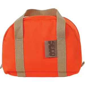
Leica GS07 GNSS Receiver
Leica GS07 GNSS Receiver - UHF Rover Kit Availability status is shown on the product page when applicable.
Delivery and Shipping
Delivery and Shipping
Your order will be carefully processed and shipped as soon as possible. A tracking number will be sent via email and/or text once the shipping label is created. For more details, please view our 60-Day Return Policy.
Speak With An Expert
Speak With An Expert
Why Choose Absolute Accuracy
Why Choose Absolute Accuracy
Since 2008, we’ve been helping pros across Los Angeles get the right gear for the job. Our team’s got your back with certified, calibrated surveying and construction equipment you can count on. We offer quick shipping, solid support, and great prices on top brands. Shop with confidence. Everything we sell is tested, reliable, and ready to perform.

Leica GS07 GNSS Receiver
Description
Description
Data Sheet | GNSS Comparison Chart
Overview
The Leica GS07 GNSS Receiver (p/n 869374) is a 320-channel, multi-frequency GNSS SmartAntenna for land surveying, topographic mapping, construction layout and as-built data collection. Pair the GS07 with a compatible Leica Captivate field controller to measure survey points, collect CAD-ready linework and stake design coordinates.
Choose a correction link that fits the job. The UHF Rover Kit is for crews working from an existing compatible RTK base station. The LTE Network Rover Kit adds one year of regional HxGN SmartNet+ for crews who get their RTK corrections through a cellular-connected data collector.
What’s Included
Both configurations include the following Leica equipment and activations.
- Leica GS07 GNSS SmartAntenna (p/n 869374)
- GVP753 GNSS Rover Container (p/n 980902)
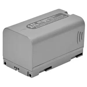
- Two GEB213 rechargeable Li-ion batteries, 7.2 V / 3,450 mAh each (p/n 961154)
- GKL311 Professional 3000 single-battery charger (p/n 799185)
- GEV192-1 U.S. AC/DC adapter for the charger (p/n 733272)
- LOP74 GLONASS activation (p/n 869410)
- LOP75 Galileo activation (p/n 869412)
- Leica CS20 / GS Sensor multilingual quick guide (p/n 896293)
UHF Rover Kit
Includes the receiver package above. A compatible base station and UHF receive hardware are required and sold separately. Leica documents UHF reception through the CS20 with the appropriate radio expansion.
LTE Network Rover Kit + 1 Year SmartNet+
Includes the receiver package above plus a one-year HxGN SmartNet+ State/Region/Area subscription (p/n 5311279). Supply the network connection through your field controller or tablet. Cellular data service is separate from the RTK correction subscription.
Choose your field controller, Captivate software license and survey pole separately.
Recommended Data Collectors for Network RTK
Choose the Leica CS20 LTE Field Controller for the GS07 pairing Leica explicitly documents. Select the LTE model and use an active cellular data plan to connect Captivate to your NTRIP correction service.
If you prefer a Windows field tablet, choose based on the screen size you need and confirm GS07 support for the installed Captivate version before ordering.
- Leica CS30 LTE is a compact 7-inch tablet for pole-mounted field data collection and stakeout.
- Leica CC180 is an 8-inch field tablet with LTE for crews that want more room to review maps and linework.
- Leica CC200 is a 10-inch Windows 11 tablet with LTE for larger drawings, surfaces and design files.
Considering the Leica CS50 4G/5G? It requires Captivate 2027 or later, and Leica’s CS50 compatibility list omits the GS07. Check with Absolute Accuracy before ordering this combination.
Network RTK, NTRIP and HxGN SmartNet+
In a network rover setup, Leica Captivate receives real-time corrections over the data collector’s internet connection and passes them to the GS07. NTRIP delivers those corrections from a reference station network, so crews can work across covered jobsites without setting up a local base at each one. Use the RTK Rover Wizard in Captivate to set the correction server, credentials and mountpoint supplied by your network provider.
The included regional SmartNet+ plan provides network RTK and short-outage bridging in the selected service area. Leica specifies bridging for up to 10 minutes under suitable conditions, with published bridging accuracy of 2.5 cm horizontally and 5 cm vertically. Confirm SmartNet coverage and cellular reception for your work area before selecting a kit.
Local Base Station and UHF Radio Corrections
UHF is an option for crews that already have a base station and work on jobsites with limited cellular coverage. Leica documents the CS20 with the CGR4 UHF radio expansion pack as a way to receive base corrections with the GS07. Match the receive radio to the base’s frequency, radio protocol, over-the-air settings and RTK correction format. The base station and rover radio hardware are sold separately.
Multi-Constellation Tracking and RTK Performance
The GS07 tracks multiple GNSS frequencies and both kits include the GLONASS and Galileo activations. Leica RTKplus adjusts satellite selection as tracking conditions change. SmartCheck monitors the RTK solution continuously, and Leica lists a typical initialization time of about six seconds under favorable conditions.
GNSS Rover Pole Setup and Field Checks
Mount the GS07 on a compatible survey pole and attach the field controller with its pole bracket. Enter the correct antenna height in Captivate and use the pole bubble to keep the rover plumb. Before collecting production shots, verify the job coordinate system and units, confirm the RTK fix, and check a known control point. Repeat the check when switching bases or correction sources.
The 0.7 kg receiver uses a field-replaceable battery and has an IP66/IP68 enclosure. Leica rates the GS07 to withstand a topple from a 2 m survey pole onto a hard surface. Both kits include a spare battery and a hard rover case for transport between jobs.
Leica Captivate CAD Stakeout and Field Data Collection
With Leica Captivate Measure & Stakeout, crews can select design points on the map, follow on-screen stakeout guidance and store the measured position. Use feature codes and attributes to organize topographic shots and connect linework in the field. With the appropriate Captivate modules and version, crews can also use DXF drawings for line and offset stakeout, or use design surfaces to check cut and fill.
Surveying and Construction Applications
- Land surveying. Check survey control, locate existing monuments and tie measured points to the project coordinate system.
- Topographic surveys and site mapping. Record spot elevations, breaklines, curb lines, drainage features and existing improvements for CAD drafting and surface modeling.
- Construction layout. Stake grading limits, curb alignments, utility offsets and other site features with the appropriate Captivate modules.
- As-built surveys. Capture installed utilities and site features before they are covered, then compare recorded positions or elevations with the design.
Static GNSS, RINEX and Leica Infinity
Log Leica raw GNSS data or RINEX through the field controller at rates up to 5 Hz. For static or rapid-static control observations, transfer the files to Leica Infinity with the appropriate GNSS processing tools for baseline processing. For RTK jobs, bring Captivate observations back into Infinity to review measurements, combine data from GNSS, total stations and levels, or prepare as-staked reports.
Technical Specifications
| Specification | Leica GS07 |
|---|---|
| GNSS tracking | 320 channels, multi-frequency and multi-constellation |
| Network RTK accuracy | Horizontal 10 mm + 0.5 ppm / vertical 20 mm + 0.5 ppm |
| Single-baseline RTK accuracy | Horizontal 10 mm + 1 ppm / vertical 20 mm + 1 ppm |
| Long static accuracy | Horizontal 3 mm + 0.5 ppm / vertical 6 mm + 0.5 ppm |
| Static and rapid-static accuracy | Horizontal 5 mm + 0.5 ppm / vertical 10 mm + 0.5 ppm |
| Position updates and logging | Up to 5 Hz |
| Correction formats | RTCM including 3.2 MSM, Leica, Leica 4G, CMR and CMR+ |
| Connectivity | Bluetooth 4.1 + EDR. USB and RS-232 via LEMO. |
| Dimensions and weight | 186 mm diameter × 71 mm high. Receiver weight 0.7 kg (1.54 lb). |
| Ingress protection | IP66 / IP68 |
| Operating temperature | −40 °C to +65 °C (−40 °F to +149 °F) |
Published accuracy depends on satellite visibility, baseline length, observation time and site conditions.
Frequently Asked Questions
Can I use the GS07 with my existing RTK network?
Yes. If your provider supplies a compatible NTRIP correction stream, enter its settings in Captivate on a supported controller with internet access. Choose the SmartNet+ bundle if you need the included one-year regional subscription.
Does the Leica GS07 have tilt compensation or visual positioning?
The GS07 is designed for plumb-pole GNSS measurements. Leica’s comparison chart lists tilt compensation and imaging on select other SmartAntenna models.
Absolute Accuracy Dealer Support
Our Los Angeles team can help you select a GS07 configuration, match a UHF radio to your existing base, or choose the field controller and Captivate license for your network rover.
Payment & Security
Payment methods
Your payment information is processed securely. We do not store credit card details nor have access to your credit card information.