Juniper Systems Mesa 3 Geo/Cell Rugged Windows 10 Tablet
Juniper Systems Mesa 3 Geo/Cell Rugged Windows 10 Tablet Availability status is shown on the product page when applicable.
Delivery and Shipping
Delivery and Shipping
Your order will be carefully processed and shipped as soon as possible. A tracking number will be sent via email and/or text once the shipping label is created. For more details, please view our 60-Day Return Policy.
Speak With An Expert
Speak With An Expert
Why Choose Absolute Accuracy
Why Choose Absolute Accuracy
Since 2008, we’ve been helping pros across Los Angeles get the right gear for the job. Our team’s got your back with certified, calibrated surveying and construction equipment you can count on. We offer quick shipping, solid support, and great prices on top brands. Shop with confidence. Everything we sell is tested, reliable, and ready to perform.

Juniper Systems Mesa 3 Geo/Cell Rugged Windows 10 Tablet
Description
Description
The Juniper Systems Mesa 3 Geo/Cell Rugged Windows 10 Tablet is a professional field computer built for surveyors, construction crews, utility professionals, GIS technicians, and public works departments that need full Windows functionality in demanding outdoor environments.
This Geo/Cell configuration adds two important capabilities to the standard Mesa 3:
- Geo includes an integrated GNSS receiver and antenna for standalone positioning, navigation, GIS data collection, and location-tagged field records.
- Cell includes an integrated multi-carrier 4G LTE modem, allowing the tablet to access cellular data wherever a compatible service plan and network connection are available.
Combined with a quad-core Intel® Pentium processor, 8 GB of RAM, a sunlight-readable 7-inch display, field-replaceable battery, and IP68 construction, the Mesa 3 Geo/Cell provides a complete mobile platform for collecting, processing, and transmitting field data.
Unlike consumer tablets placed inside protective cases, the Mesa 3 is engineered from the ground up for professional outdoor work. It runs the full Windows 10 operating system, allowing users to install familiar surveying, GIS, construction, inspection, and office applications directly on the tablet.
Key Features
- Geo/Cell configuration with integrated GNSS and 4G LTE
- Full Microsoft® Windows 10 operating system
- Quad-core Intel® Pentium N4200 processor
- 8 GB LPDDR4 system memory
- 128 GB or 256 GB flash storage
- MicroSDXC memory-card expansion
- Bright 7-inch sunlight-readable display
- Touchscreen works with gloves, a small-tip stylus, and in wet conditions
- Integrated GNSS with approximately 2–5 m typical positioning accuracy
- Integrated real-time SBAS support
- Multi-carrier-capable 4G LTE modem
- Bluetooth® 5.0 and dual-band Wi-Fi
- Removable battery for easy field replacement
- Optional internal battery for hot-swapping
- IP68 waterproof and dustproof construction
- Designed to meet MIL-STD-810G test procedures
- Optional RS-232 serial connection
- Programmable physical function keys
- Designed and assembled in the United States
What Does Geo/Cell Mean?
The Geo/Cell designation identifies a Mesa 3 equipped with both integrated geographic positioning and cellular communication.
Integrated Geo GNSS
The Geo configuration includes a built-in u-blox NEO-M8N GNSS receiver and antenna. It offers approximately 2–5 m typical positioning accuracy and includes real-time SBAS correction support such as WAAS and EGNOS.
This integrated receiver is useful for:
- General GIS asset collection
- Navigating to existing field locations
- Recording inspection locations
- Adding coordinates to photographs or field records
- Locating utilities, signs, valves, poles, and other assets
- Providing an approximate position before connecting external survey equipment
The internal Geo receiver is intended for mapping and navigation-level positioning. It should not be confused with a survey-grade RTK GNSS receiver capable of centimeter-level accuracy. Survey crews can still connect the Mesa 3 to an external GNSS receiver when higher accuracy is required.
Integrated Cellular Connectivity
The Cell configuration adds a multi-carrier-capable 4G LTE modem. With an activated cellular plan and compatible network service, the Mesa 3 can connect to internet-based services without relying on a Wi-Fi hotspot.
Cellular connectivity can be used to:
- Access GNSS correction networks
- Connect to NTRIP services through compatible field software
- Upload and download project files
- Send measurements back to the office
- Access cloud-based mapping platforms
- Receive email and project updates
- Use online maps and reference information
- Communicate with office personnel from the field
Actual cellular service, compatibility, and coverage depend on the installed modem, carrier, active data plan, and local network availability.
Full Windows 10 Field Computer
One of the Mesa 3’s greatest advantages is its ability to run the full Windows applications professionals already use.
The tablet is powered by an Intel Quad-Core Pentium N4200 processor with 8 GB of LPDDR4 RAM, providing the performance needed for detailed maps, large project files, field drawings, and demanding data-collection software.
Unlike mobile devices limited to Android or iOS applications, the Mesa 3 can run compatible Windows programs directly in the field. This provides greater flexibility for organizations using specialized surveying, construction, GIS, inspection, or asset-management software.
Common uses include:
- Survey data collection
- GNSS receiver control
- Manual and robotic total-station operation
- Construction layout
- GIS mapping
- Utility inspection
- CAD and PDF plan viewing
- Asset-management applications
- Microsoft Office applications
- File management and field reporting
Built for Surveying and Construction Software
The Mesa 3’s Windows operating system makes it suitable for many professional field-software packages.
Depending on the software version, licensing, instrument drivers, and connected equipment, the Mesa 3 may be used with platforms such as:
- Carlson SurvPC
- Topcon Field
- MAGNET Field
- MicroSurvey FieldGenius
- GNSS configuration utilities
- GIS data-collection platforms
- Construction layout software
- Inspection and asset-management applications
The tablet can communicate with compatible GNSS receivers, total stations, and other field instruments through Bluetooth, Wi-Fi, USB, an optional RS-232 port, or supported docking accessories.
Software, instrument drivers, and licenses are sold separately unless specifically listed as part of the selected package.
Designed for Professional Field Work
The Mesa 3 is purpose-built for professionals who spend their workday outdoors rather than behind a desk.
Its ergonomic enclosure is designed to remain comfortable during extended handheld use. Impact-absorbing overmolded bumpers provide a secure grip while protecting the tablet from everyday knocks, transportation, and field handling.
Physical controls include:
- Four-way directional navigation pad
- Windows/Home key
- Enter key
- Power button
- Three programmable function keys
- Adjustable LED-backlit keypad
The programmable buttons can be assigned to frequently used functions within compatible software, reducing the need to navigate touchscreen menus for every command.
This combination of physical controls and touchscreen input is particularly helpful when wearing gloves, working in rain, carrying the tablet on a pole, or operating equipment in cold conditions.
Sunlight-Readable 7-Inch Display
The Mesa 3 features a 7-inch WXGA display with a resolution of 1280 × 800.
Its high-visibility backlit LCD is designed to remain readable outdoors, helping operators view maps, point lists, drawings, and measurement screens in bright field conditions.
The display supports both portrait and landscape orientation with automatic screen rotation. Its projected capacitive multi-touch interface can be operated using:
- Bare fingers
- Work gloves
- A small-tip capacitive stylus
- Wet-touch input
The display is optically bonded to improve visibility and structural strength. Chemically strengthened Dragontrail™ High Ion-Exchange cover glass provides additional impact and scratch resistance.
Integrated GNSS for GIS and Navigation
The Mesa 3 Geo model includes a 72-channel GNSS receiver with an integrated antenna and real-time SBAS support.
The internal receiver gives field crews immediate access to location information without carrying a separate recreational-grade GPS device. It can support general GIS and asset-management tasks where mapping-grade or navigation-level positioning is appropriate.
Typical applications include:
- Finding previously mapped assets
- Recording approximate inspection locations
- Collecting signs, hydrants, poles, valves, and other infrastructure
- Adding location information to field forms
- Navigating between jobs or project points
- Supporting preliminary site reconnaissance
For precise surveying, staking, boundaries, construction layout, or other work requiring centimeter-level results, the Mesa 3 should be connected to an appropriate survey-grade GNSS receiver.
4G LTE for Connected Field Workflows
The integrated cellular modem turns the Mesa 3 into a connected field office.
Where cellular service is available, operators can transfer data and access online services without returning to a vehicle, office, or Wi-Fi network. This can shorten the time between data collection and office review while allowing crews to receive updated project information throughout the day.
For GNSS users, cellular connectivity may also allow compatible field software to connect to an internet-based correction service. The exact workflow depends on the connected receiver, software, correction provider, and cellular plan.
The modem is described as multi-carrier capable, but carrier activation and compatibility should be confirmed before service is established.
Flexible Wireless and Physical Connectivity
In addition to integrated cellular and GNSS capabilities, the Mesa 3 offers several ways to connect with field instruments and office systems.
Wireless Connectivity
- Bluetooth® 5.0 with EDR and BLE support
- Wi-Fi 802.11 a/b/g/n/ac
- 2.4 GHz and 5 GHz Wi-Fi
- 2 × 2 MIMO
- Multi-carrier-capable 4G LTE
Physical Connections
- USB 3.0 port
- MicroSDXC card slot
- 12V DC power input
- 3.5 mm audio jack
- Docking connector
- Optional RS-232 9-pin serial connector
The docking connector supports power, USB 2.0, HDMI, and Ethernet through compatible docking accessories.
This range of interfaces helps the Mesa 3 work with both current wireless instruments and older equipment that may still require a physical serial connection.
Rugged Enough for Demanding Jobsites
The Mesa 3 meets an IP68 environmental rating, providing protection against dust and water exposure. Its published water-resistance specification includes immersion to approximately 1.4 m (4 ft. 7 in.) for two hours.
It is also designed to meet MIL-STD-810G test procedures covering environmental stresses such as:
- Low pressure and altitude
- High temperature
- Low temperature
- Temperature shock
- Rain
- Humidity
- Sand and dust
- Water immersion
- Vibration
- Shock
The tablet is rated to survive multiple drops from approximately four feet onto concrete, depending on configuration and testing conditions.
Its operating temperature range extends from -20°C to 50°C (-4°F to 122°F), allowing it to remain productive through cold mornings, summer heat, dusty sites, and wet weather.
Replaceable Battery and Hot-Swap Capability
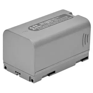
The Mesa 3 is powered by a removable 43.2 Wh lithium-ion battery that provides approximately 8–10 hours of operation under typical use.
Because the main battery is removable, crews can carry a charged spare and replace the depleted battery in the field instead of taking the tablet out of service for charging.
An optional 21.6 Wh internal battery adds approximately four to five hours of runtime and enables hot-swapping. With the internal battery installed, the primary battery can be replaced while the tablet remains powered on and the current application stays open.
This is especially useful for:
- Long survey days
- Extended utility inspections
- Multi-shift projects
- Remote work without charging access
- Continuous data-collection operations
Battery runtime varies based on screen brightness, processor load, cellular use, GNSS use, wireless connectivity, temperature, and battery condition.
Camera and Field Documentation
Geo models include:
- 8 MP rear-facing camera with LED illumination
- 2 MP front-facing camera
The rear camera can be used to document site conditions, damaged infrastructure, survey monuments, utility assets, equipment installations, and construction progress.
When used with compatible software, photographs can be associated with project records or field observations. The integrated GNSS receiver can also support location-aware documentation workflows.
Ideal Applications
Land Surveying
Use the Mesa 3 as a Windows data collector for compatible GNSS receivers and total stations. Its physical keys, rugged construction, sunlight-readable display, and optional serial connection make it well suited to field surveying.
Construction Layout
Run compatible layout software, review plans, connect to positioning instruments, and transfer project updates using cellular or Wi-Fi connectivity.
GIS and Asset Management
Use the integrated GNSS receiver to record general asset locations and the cellular connection to synchronize records with office or cloud-based systems.
Utilities and Public Works
Inspect and document water, wastewater, electrical, gas, telecommunications, roadway, and municipal infrastructure.
Environmental and Forestry Work
Collect field observations, map approximate locations, review aerial imagery, and submit data from remote project areas.
Engineering and Inspection
View drawings, complete digital forms, take photographs, document defects, and transfer reports without waiting to return to the office.
Technical Specifications
| Specification | Detail |
|---|---|
| Configuration | Geo/Cell |
| Operating System | Microsoft Windows 10 |
| Processor | Quad-Core Intel Pentium N4200 |
| Memory | 8 GB LPDDR4 |
| Internal Storage | 128 GB or 256 GB flash storage |
| Expandable Storage | MicroSDXC card slot |
| Display | 7-inch WXGA high-visibility LCD |
| Display Resolution | 1280 × 800 |
| Touchscreen | Multi-touch; glove, stylus, and wet-condition capable |
| Integrated GNSS | u-blox NEO-M8N |
| Typical Internal GNSS Accuracy | Approximately 2–5 m |
| GNSS Channels | 72 |
| Correction Support | Real-time SBAS, including WAAS and EGNOS |
| Cellular | Multi-carrier-capable 4G LTE |
| Bluetooth | Bluetooth 5.0 + EDR, BLE |
| Wi-Fi | 802.11 a/b/g/n/ac, 2.4 and 5 GHz |
| Standard Port | USB 3.0 |
| Optional Port | RS-232 9-pin serial |
| Docking Connection | Power, USB 2.0, HDMI, and Ethernet support |
| Rear Camera | 8 MP with LED illumination |
| Front Camera | 2 MP |
| Main Battery | Removable 43.2 Wh Li-Ion |
| Standard Runtime | Approximately 8–10 hours |
| Optional Internal Battery | 21.6 Wh; adds approximately 4–5 hours |
| Hot-Swap Support | Available with optional internal battery |
| Environmental Rating | IP68 waterproof and dustproof |
| Rugged Testing | Designed to meet MIL-STD-810G procedures |
| Operating Temperature | -20°C to 50°C / -4°F to 122°F |
| Storage Temperature | -30°C to 70°C / -22°F to 158°F |
| Dimensions | 137 × 215 × 35 mm / 5.40 × 8.48 × 1.36 in. |
| Weight | Approximately 680–907 g / 1.5–2 lb., depending on configuration |
| Security | TPM 2.0 |
| Manufacturing | Designed and assembled in the USA |
| Warranty | 2 years |
What’s Included
- 1 × Juniper Systems Mesa 3 Geo/Cell Rugged Windows 10 Tablet
- 1 × Standard Removable Li-Ion Battery
- 1 × AC Wall Charger with International Plug Kit
- 1 × Capacitive Small-Tip Stylus with Tether
- 1 × Hand Strap
- 1 × Connector Port Dust Cover
- 1 × Quick Start Guide
- 1 × Two-Year Manufacturer Warranty
A cellular service plan, SIM or carrier activation, field software, external survey receiver, mounting accessories, spare batteries, docks, and other optional accessories are not included unless specifically stated in the selected package.
A Connected Windows Field Office
The Juniper Systems Mesa 3 Geo/Cell combines a rugged Windows computer, integrated GNSS receiver, and cellular data capability in one field-ready device.
The Geo functionality provides convenient onboard positioning for navigation, inspection records, and general GIS collection, while the Cell functionality keeps crews connected to correction services, cloud platforms, office files, and internet-based resources where compatible cellular coverage is available.
For professionals who need to run full Windows software while working around rain, dust, temperature extremes, and rough handling, the Mesa 3 delivers a dependable platform designed specifically for field data collection.
Payment & Security
Payment methods
Your payment information is processed securely. We do not store credit card details nor have access to your credit card information.