
Carlson SurvCE Field Software
Carlson SurvCE Field Software - SurvCE Basic 6.xx (Contains TS Only) is backordered and will ship as soon as it is back in stock.
Delivery and Shipping
Delivery and Shipping
Your order will be carefully processed and shipped as soon as possible. A UPS tracking number will be sent via email and/or text once the shipping label is created. For more details, please view our 60-Day Return Policy.
Speak With An Expert
Speak With An Expert
Why Choose Absolute Accuracy
Why Choose Absolute Accuracy
Since 2008, we’ve been helping pros across Los Angeles get the right gear for the job. Our team’s got your back with certified, calibrated surveying and construction equipment you can count on. We offer quick shipping, solid support, and great prices on top brands. Shop with confidence. Everything we sell is tested, reliable, and ready to perform.

Carlson SurvCE Field Software
All Instruments Will Ship Calibrated
Certification Provided For Optical & Lasers
Description
Description
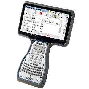
Carlson SurvCE is a powerful and user-friendly field data collection software built specifically for land surveyors using RTK GNSS and total stations. Designed with a surveyor’s workflow in mind, SurvCE runs on Windows Mobile CE and supports a wide range of equipment including Topcon, Sokkia, Trimble, Spectra, Leica, Stonex, and more. Its intuitive interface and real-time visual feedback make it easy to capture accurate data and boost field efficiency.
SurvCE offers rich support for CAD formats including .dwg, .dgn, and .dxf, making data exchange seamless. With built-in Field-to-Finish capabilities, users can automatically generate linework and codes as they survey, minimizing post-processing. The software also supports KML export for fast integration with Google Earth, and integrates with your device’s camera to attach photos to points or lines in the field.
Key Features
- Enhanced Search: Multiple search modes for total station and robotic tracking across all survey screens
- Voice Prompting in Stakeout: Keeps your eyes on the job while guiding you with audio cues
- Map Overlays: Supports Google Maps, Open Street Maps, Esri® layers, and custom WMS services
- GIS Inspector: Access and edit GIS attribution directly in the map screen
- Surface Inspector: Instantly compare plan vs. as-built elevations
- Obstructed Point Stakeout: Stake inaccessible points using guided azimuth and distance methods
- Automatic Backsight Check: Confirm setup instantly from the joystick screen
- Volume Calculation: Quickly compute cut/fill volumes in the field
- Camera Integration: Assign photos to specific points or linework
- Broad Compatibility: Runs on hundreds of current and legacy GNSS and total station models
Whether you’re laying out points, inspecting surfaces, or collecting topo data, Carlson SurvCE helps streamline your work with precision, speed, and reliability. It’s an ideal solution for survey professionals seeking robust field functionality without complexity.
Payment & Security
Payment methods
Your payment information is processed securely. We do not store credit card details nor have access to your credit card information.