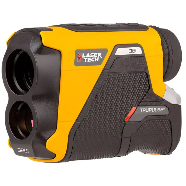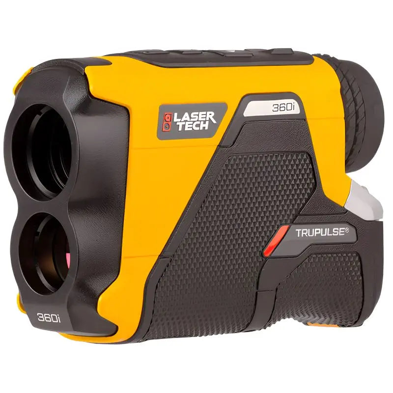


LaserTech TruPulse 360i Laser Rangefinder
LaserTech TruPulse 360i Laser Rangefinder está agotado y se enviará tan pronto como vuelva a estar disponible.
Entrega y Envío
Entrega y Envío
Todos los equipos en stock se enviarán dentro de las 24 horas posteriores a la compra.
Se proporcionará un número de seguimiento de UPS por correo electrónico o mensaje de texto cuando creemos la etiqueta.
Para equipos en espera de entrega, espere de 3 a 5 días adicionales de envío + proceso de calibración.
Speak With An Expert
Speak With An Expert
Igualación de precios
Igualación de precios
¿Encontró un mejor precio?
Envíenos un correo electrónico con un enlace a la lista de distribuidores autorizados y lo igualaremos o lo mejoraremos.
info@aaisurvey.com
LaserTech TruPulse 360i Laser Rangefinder
Descripción
Descripción
Call or email for special pricing
(323) 662-9237 | info@aaisurvey.com
Brochure
Compass Calibration Sheet
User Manual
Quick Reference Field Guide
The TruPulse® 360i Laser Rangefinder is a professional-grade laser rangefinder engineered for surveyors, GIS professionals, foresters, utility crews, engineers, and construction specialists who need more than just distance measurements. Combining long-range laser technology with Laser Technology's exclusive TruVector 360° Compass Technology, the TruPulse 360i captures distance, inclination, and azimuth in a single shot, allowing users to accurately locate remote features, perform laser offset mapping, and calculate complete three-dimensional relationships between inaccessible points.
As the successor to the original TruPulse 360°, the TruPulse 360i delivers 50% greater distance accuracy, 60% greater inclination accuracy, and up to 25% more effective range, while introducing faster target acquisition, Bluetooth Dual Mode connectivity, improved optics, and a brighter display for easier operation in any environment.
With a measurement range of up to 2,500 meters (8,202 feet), onboard 3D calculations, and a rugged IP67-rated housing, the TruPulse 360i is built to provide reliable measurements in the field day after day.
Key Features
- Measures distance, inclination, azimuth, horizontal distance, vertical distance, height, and 3D missing lines
- Measurement range up to 2,500 meters (8,202 feet)
- Distance accuracy up to ±0.1 m
- Azimuth accuracy of <1° RMS
- Exclusive TruVector 360° Compass Technology
- Faster target acquisition with visual, audible, and tactile feedback
- Advanced TruTargeting modes
- Bluetooth 4.0 Dual Mode (BLE & Classic)
- Compatible with Android, iOS, and Windows
- Ultra-bright LED display with five brightness levels
- 5× magnification optics
- Adjustable range gates
- Magnetic declination adjustment
- IP67 waterproof and dustproof
- Lightweight magnesium chassis with rubber-armored aluminum housing
Why Choose the TruPulse 360i?
Many laser rangefinders accurately measure distance, but relatively few can determine exactly where a target is located.
The TruPulse 360i measures distance, inclination, and compass heading simultaneously, allowing compatible software to calculate the precise position of remote features without occupying the target itself. Whether you're mapping utility poles, collecting GIS assets beneath heavy tree canopy, measuring conductor clearances, or documenting structures from a safe distance, the 360i dramatically reduces field time while improving measurement confidence.
For many professionals, it replaces multiple handheld instruments with one rugged, easy-to-use solution.
TruVector 360° Compass Technology
The defining feature of the TruPulse 360i is its integrated TruVector 360° Compass Technology.
Unlike conventional electronic compasses that require the instrument to remain level, TruVector combines a three-axis magnetic sensor and a three-axis inclinometer to automatically compensate for pitch and roll. This allows the TruPulse 360i to produce highly repeatable azimuth measurements regardless of how the instrument is tilted while aiming.
The system continuously monitors environmental conditions, detects movement that could degrade compass accuracy, and prompts calibration when necessary. The result is dependable directional measurements that professionals can trust for mapping, asset collection, and engineering applications.
Seven Measurement Solutions in One Instrument
The TruPulse 360i performs seven primary measurement functions directly from the field:
- Slope Distance
- Horizontal Distance
- Vertical Distance
- Inclination
- Azimuth
- Height
- 3D Missing Line
Because all calculations occur within the instrument, operators receive immediate results without manual calculations or additional software.
Professional Accuracy for Critical Measurements
Accuracy is one of the biggest improvements over previous TruPulse models.
The TruPulse 360i can achieve 10 cm (4-inch) distance accuracy when measuring high-quality targets out to 1,000 meters and maintains excellent precision even at longer distances.
Tilt measurements are accurate to:
- ±0.1° from 0° to ±30°
- ±0.2° from ±30° to ±90°
Compass measurements are accurate to less than 1° RMS, making the 360i suitable for professional GIS data collection, utility documentation, forestry inventory, and engineering work.
Advanced TruTargeting Technology
Not every job involves a perfectly isolated target.
The TruPulse 360i includes five targeting modes designed for different environments.
- Standard
- Closest
- Farthest
- Continuous
- Filter
Whether measuring through brush, selecting one utility pole among many, or targeting reflective prisms at long distances, TruTargeting helps ensure the laser returns the correct measurement.
Visual, audible, and tactile feedback immediately confirm when a successful measurement has been acquired.
3D Missing Line Measurements
One of the TruPulse 360i's greatest advantages is its ability to calculate complete three-dimensional relationships between two remote points.
Instead of physically occupying each point, simply measure both targets from your location, and the instrument automatically calculates:
- Horizontal distance
- Vertical distance
- Slope distance
- Inclination
- Relative azimuth
This function is invaluable when measuring:
- Pole-to-pole spans
- Wire clearances
- Guy wires
- Building dimensions
- Stockpiles
- Trees
- Bridges
- Remote structures
Bluetooth Dual Mode Connectivity
The TruPulse 360i communicates wirelessly using Bluetooth 4.0 Dual Mode.
Support for both Bluetooth Low Energy and Classic Bluetooth allows the instrument to connect with:
- Android devices
- Apple iOS devices
- Windows tablets
- GIS software
- Data collectors
- Asset management applications
Wireless communication reduces transcription errors and speeds up field workflows by transferring measurements directly into compatible software.
TruPulse 200i vs. TruPulse 360i
Both the TruPulse 200i and TruPulse 360i are built on the same next-generation laser platform. They share the same long measurement range, improved optics, enhanced targeting modes, Bluetooth Dual Mode connectivity, ultra-bright display, rugged IP67 construction, and improved distance and inclination accuracy.
The key difference is the addition of TruVector 360° Compass Technology in the TruPulse 360i.
Choose the TruPulse 200i if you need:
- Distance measurements
- Height calculations
- Horizontal and vertical distance
- 2D missing-line measurements
- Forestry and construction measurements
- A lower-cost professional laser rangefinder
Choose the TruPulse 360i if you need:
- Distance plus compass heading
- GIS laser offset mapping
- Remote asset positioning
- Utility pole inventory
- Facility mapping
- Tree inventory with azimuth
- Complete 3D missing-line calculations
- True North or magnetic declination correction
For users working with GNSS receivers, GIS software, or utility mapping systems, the TruPulse 360i provides capabilities that simply are not possible with the TruPulse 200i.
Built for Demanding Field Conditions
The TruPulse 360i is designed to perform reliably in harsh outdoor environments.
Its magnesium chassis provides excellent strength while minimizing weight, and the rubber-armored aluminum housing protects against impacts encountered during daily field use.
An IP67 environmental rating protects against dust and water intrusion, allowing confident operation in rain, snow, dusty construction sites, and forestry applications.
The instrument operates from -20°C to 60°C (-22°F to 140°F), making it suitable for virtually any climate.
Ideal Applications
The TruPulse 360i is trusted by professionals across numerous industries.
GIS & Asset Management
Collect highly accurate locations of utility poles, signs, valves, hydrants, electrical equipment, communication infrastructure, and other remote assets without physically occupying each point.
Forestry
Measure tree heights, canopy dimensions, stand spacing, timber inventory, and vegetation encroachment while working beneath dense canopy.
Utility & Power Distribution
Perform pole inspections, conductor clearance measurements, guy-wire documentation, pole lean assessments, and vegetation management.
Construction & Engineering
Measure building heights, excavation depths, crane clearances, bridge dimensions, stockpiles, and inaccessible structures.
Surveying
Support reconnaissance surveys, remote measurements, topographic mapping, and GNSS laser-offset workflows.
Technical Specifications
| Specification | Value |
|---|---|
| Range | 0.5–2,500 m (20 in–8,202 ft) |
| Distance Accuracy | ±0.1 m (<1000 m) |
| Inclination Accuracy | ±0.1° / ±0.2° |
| Azimuth Accuracy | <1° RMS |
| Magnification | 5× |
| Display | Ultra-Bright LED HUD |
| Bluetooth | BLE & Classic |
| Battery | Two AA |
| Battery Life | Approx. 6 hrs / 1,000 alkaline measurements; up to 40 hrs / 6,300 lithium measurements |
| Waterproof Rating | IP67 |
| Weight | 382.6 g with batteries |
| Dimensions | 88 × 43.4 × 118.3 mm |
| Operating Temperature | -20°C to 60°C |
| Tripod Mount | 1/4"-20 |
What's Included
- 1 × Laser Technology TruPulse 360i Laser Rangefinder
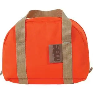
- 1 × Carrying Case
- 1 × Neck Strap
- 2 × AA Batteries
- 1 × Warranty Information
- 1 × Quick Reference Guide
- 1 × User Documentation
Precision Measurements Without Compromise
Whether you're locating remote GIS assets, documenting utility infrastructure, measuring tree heights, calculating conductor clearances, or performing engineering inspections, the Laser Technology TruPulse 360i delivers the accuracy, reliability, and advanced onboard calculations professionals demand.
By combining long-range laser measurement with TruVector 360° Compass Technology, Bluetooth connectivity, and rugged field-ready construction, the TruPulse 360i provides a complete measurement solution that reduces field time, improves data quality, and helps you complete demanding projects with confidence.
Pago y seguridad
Métodos de pago
Su información de pago se procesa de forma segura. No almacenamos los datos de su tarjeta de crédito ni tenemos acceso a la información de su tarjeta de crédito.