Stonex Cube-3d Photogrammetry & 3D Data Software
Stonex Cube-3d Photogrammetry & 3D Data Software - Photo está agotado y se enviará tan pronto como vuelva a estar disponible.
Entrega y Envío
Entrega y Envío
Todos los equipos en stock se enviarán dentro de las 24 horas posteriores a la compra.
Se proporcionará un número de seguimiento de UPS por correo electrónico o mensaje de texto cuando creemos la etiqueta.
Para equipos en espera de entrega, espere de 3 a 5 días adicionales de envío + proceso de calibración.
Speak With An Expert
Speak With An Expert
Igualación de precios
Igualación de precios
¿Encontró un mejor precio?
Envíenos un correo electrónico con un enlace a la lista de distribuidores autorizados y lo igualaremos o lo mejoraremos.
info@aaisurvey.com
Todo el equipo se enviará calibrado.
Los instrumentos ópticos y los láseres rotatorios vienen con una certificación
Descripción
Descripción
More tutorials on how to use Cube-3d
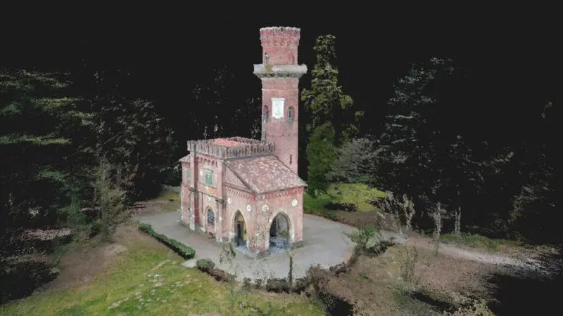
Stonex Cube-3D is a powerful desktop solution for processing, managing, and modeling 3D point clouds. Designed for professionals working in surveying, engineering, construction, mining, and architecture, Cube-3D transforms raw spatial data into high-value, actionable deliverables. Whether you're importing data from terrestrial laser scanners, drones, or SLAM systems like the Stonex XVS, Cube-3D enables you to clean, register, align, and model with precision.
The software supports a full scan-to-model workflow—from point cloud alignment and mesh generation to the extraction of topographic features, volume calculations, and the creation of CAD-ready outputs. With robust compatibility for file types like LAS, PLY, OBJ, and DXF, Cube-3D integrates seamlessly into your existing toolchain and delivers reliable results whether you're working with simple terrain scans or complex infrastructure projects.
So why do you need Cube-3D? Because capturing data is only half the job. Cube-3D allows you to extract real value from your 3D scans—turning field data into deliverables like contours, sections, 3D meshes, and more. It reduces reliance on third-party software, improves accuracy, and gives you full control over your datasets from start to finish.
Key Features:
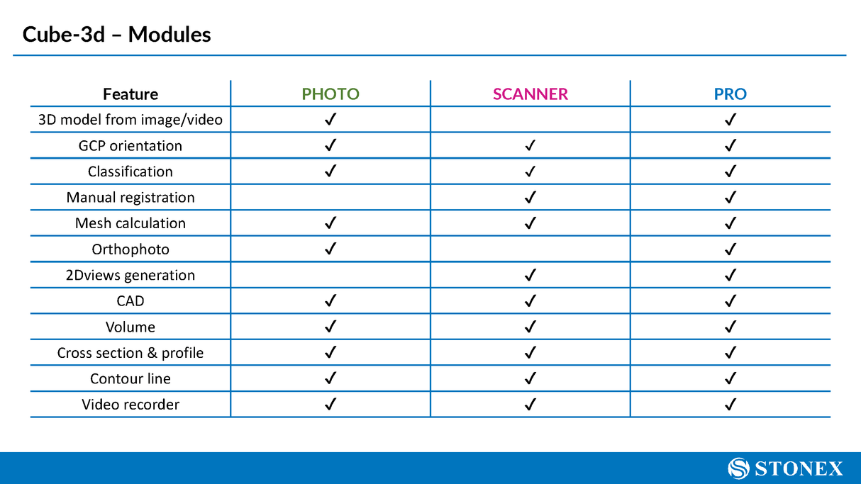
- Point Cloud Registration – Accurately align and merge multiple scans using visual or automatic registration tools
- Data Cleaning & Editing – Remove noise, crop regions, classify points, and refine datasets with precision tools
- Mesh & Surface Modeling – Create triangulated surfaces and textured meshes directly from point clouds
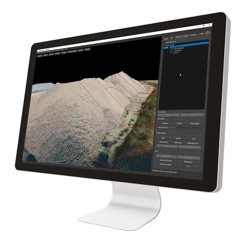
- Section & Contour Extraction – Slice data for profiles, floor plans, and generate elevation contours with ease
- Volume & Measurement Tools – Calculate areas, volumes, distances, and angles directly from 3D models
- Multi-Sensor Compatibility – Supports data from terrestrial scanners, UAV photogrammetry, GNSS, and vSLAM systems
- CAD Export Support – Export in standard formats such as DXF, PLY, OBJ, and XYZ for easy integration into CAD or BIM environments
- Visualization Tools – View and navigate data in 2D/3D modes with intuitive controls for zoom, rotate, and pan
Why Cube-3D?
Cube-3D fills the critical role between field data capture and final deliverables. It eliminates the need for multiple software platforms, streamlines workflows, and puts surveyors and engineers back in control of their own 3D data—whether you're performing topographic surveys, modeling infrastructure, or analyzing terrain.
Pago y seguridad
Métodos de pago
Su información de pago se procesa de forma segura. No almacenamos los datos de su tarjeta de crédito ni tenemos acceso a la información de su tarjeta de crédito.
