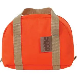
Topcon CR-S1 Professional Handheld 3D Scanner
Topcon CR-S1 Professional Handheld 3D Scanner - Without TopNet Live está agotado y se enviará tan pronto como vuelva a estar disponible.
Entrega y Envío
Entrega y Envío
Todos los equipos en stock se enviarán dentro de las 24 horas posteriores a la compra.
Se proporcionará un número de seguimiento de UPS por correo electrónico o mensaje de texto cuando creemos la etiqueta.
Para equipos en espera de entrega, espere de 3 a 5 días adicionales de envío + proceso de calibración.
Speak With An Expert
Speak With An Expert
Igualación de precios
Igualación de precios
¿Encontró un mejor precio?
Envíenos un correo electrónico con un enlace a la lista de distribuidores autorizados y lo igualaremos o lo mejoraremos.
info@aaisurvey.com

Topcon CR-S1 Professional Handheld 3D Scanner
Descripción
Descripción
Resource Hub, How-To & Workflow Guides
Data Sheet
Brochure
Overview
The Topcon CR-S1 Professional Handheld 3D Scanner is a portable SLAM LiDAR scanner built for fast, accurate, one-person reality capture. Designed for construction, surveying, geospatial, engineering, utilities, infrastructure, facilities, and stockpile applications, the CR-S1 allows users to scan while walking through complex environments and capture a complete 3D record of the site.
Using advanced multi-sensor fusion, the CR-S1 combines MLF-SLAM, visual SLAM, RTK-SLAM, PPK-SLAM, LiDAR, IMU, visual data, and GNSS positioning to deliver stable and repeatable results. This makes it a powerful solution for outdoor sites, indoor spaces, tunnels, utilities, stockpile areas, dense construction sites, urban corridors, and GNSS-challenged environments.
With handheld, vehicle, and drone mounting options, the CR-S1 gives teams the flexibility to adapt the scanner to the job and capture more area faster across large or hard-to-reach environments.
Key Features
- Professional handheld SLAM 3D scanner for reality capture
- Compact, lightweight design for one-person operation
- MLF-SLAM, PPK-SLAM, RTK-SLAM, and SLAM mapping methods
- Absolute accuracy less than 3 cm (1.18 in.)
- Relative accuracy less than 1 cm (0.39 in.)
- Repeat accuracy less than 2 cm (0.79 in.)
- LiDAR scan rate of 320,000 points per second
- LiDAR detection range up to 120 m (393.70 ft)
- 905 nm Class 1 eye-safe laser
- 280° horizontal and 360° vertical field of view
- Real-time colorization and real-time processing support
- 5-camera imaging system for panoramic capture
- 512 GB SSD internal storage
- 1408-channel GNSS receiver with NTRIP support
- RTK accuracy of 0.8 cm + 1 ppm horizontal and 1.5 cm + 1 ppm vertical
- RTK, PPK, and GCP support for georeferenced workflows
- Outputs colored point clouds in LAS format
- Outputs panoramic images in JPG format
- IP64 protection rating
- Lightweight 2.2 kg (4.85 lb) design with base, battery, and RTK module
What’s Included
- 1 × Topcon CR-S1 Handheld System (p/n: 1081790-01)
- 1 × CR-S1 Main Unit
- 1 × CR-S1 LiDAR & Camera Protective Cover
- 1 × CR-S Phone Mount
- 1 × Device Carrying Case
- 1 × CR-S1 Carton Box
- 1 × CR-S Base Stand
- 1 × Installation Tool
- 1 × CR-S1 Quick Start Guide
- 2 × CR-S Batteries
- 1 × CR-S Charger & Adapter
- 1 × USB Flash Drive
- 1 × CR-S Data Cable
- 1 × myTopcon Registration Card
- 1 × Collage Web Single User Subscription, 100 GB Storage / Streaming (p/n: 1022937-60)
- Optional: 1 × Topnet Live RPT AM 12-Month Mass Data Subscription (p/n: 1085117-01)
Topnet Live is optional and is included only when selecting the CR-S1 configuration with Topnet. It provides access to GNSS correction services for RTK-supported workflows and helps improve positioning confidence when collecting georeferenced scan data.
What Is Topnet Live?
Topnet Live is Topcon’s real-time GNSS correction service used to improve positioning accuracy for GNSS receivers in surveying, construction, GIS, mapping, agriculture, machine control, and related applications. Instead of setting up your own local base station, a compatible rover can receive correction data through Topnet Live to achieve more accurate field positioning.
For the CR-S1, Topnet Live is useful when you want stronger georeferenced scan data in supported coverage areas. It can help connect the scanner’s RTK workflow to correction services, improving positioning confidence during reality capture.
Topnet Live includes different correction service options, including Realpoint RTK, Skybridge RTK backup, and Starpoint Pro PPP. Realpoint provides network RTK corrections via NTRIP, with horizontal accuracy listed at 2 cm, while Starpoint Pro provides global PPP corrections with horizontal accuracy of 3 cm and vertical accuracy of 5 cm.
In simple terms, Topnet Live helps the CR-S1 locate itself more accurately, especially when collecting georeferenced scan data for mapping, construction documentation, utilities, stockpiles, and site records.
Built for Fast Reality Capture
The CR-S1 is designed to help crews collect more data in less time. Instead of setting up a traditional scanner at multiple tripod locations, users can walk the site and capture spatial data continuously. This mobile workflow helps improve productivity while reducing return visits and rework.
Ideal applications include:
- Construction documentation
- Progress monitoring
- Topographic surveying
- Utility mapping
- Facilities documentation
- Infrastructure inspection
- Volume calculations
- Underground data capture
- Tunnel and mining documentation
- Stockpile measurements
- Indoor and outdoor mapping
- As-built surveys
The CR-S1 provides users with a faster way to document existing conditions and convert field scans into measurable 3D records.
Capture in Challenging Environments
The CR-S1 is built for environments where traditional GNSS workflows may be difficult. It can be used in interiors, tunnels, covered areas, utility corridors, urban environments, dense construction sites, and other areas where satellite visibility may be limited.
By combining LiDAR, camera, IMU, RTK, PPK, and GCP support, the CR-S1 helps maintain reliable positioning and usable scan results across changing site conditions.
Handheld, Vehicle, and Drone Workflows
The Topcon CR-S1 is not limited to handheld use. It is designed for flexible data capture with handheld, vehicle, and drone mounting options. This allows teams to choose the best method for the project.
Handheld scanning is ideal for buildings, job sites, interiors, utilities, tunnels, and areas where users need to walk the site. Vehicle-mounted systems help capture larger areas faster. Drone mounting supports broader coverage and hard-to-reach environments where walking or driving may not be practical.
Survey-Grade Accuracy in a Portable Scanner
The CR-S1 is built to deliver professional accuracy in a portable package. With relative accuracy of less than 1 cm and absolute accuracy of less than 3 cm, it gives surveyors, contractors, engineers, and mapping teams confidence in their collected data.
Its 1408-channel RTK GNSS module supports major satellite systems and NTRIP corrections. The system also supports PPK and GCP workflows, providing users with multiple ways to enhance georeferencing and increase confidence in final deliverables.
Real-Time Point Cloud Preview
The CR-S1 supports real-time processing and real-time colorized point cloud preview. This allows crews to confirm scan coverage while still on site, helping reduce missed areas and avoid unnecessary return trips.
This is especially useful when scanning complex spaces, stockpiles, tunnels, utilities, and active construction sites where incomplete capture can create costly delays.
MAGNET Flow, MAGNET Bridge, and Collage Web
Topcon supports the CR-S1 with a connected field-to-office workflow.
MAGNET Flow provides collection control software for Android and iOS platforms. It supports collection control, project management, real-time point cloud browsing, and firmware upgrades.
MAGNET Bridge provides SLAM data processing, length, area, and volume calculations, and orthophoto creation for true-scale imagery. Each CR-S1 kit includes a perpetual MAGNET Bridge Desktop license.
Collage Web gives teams a cloud-based way to share scan results. Each CR-S1 kit includes a 1-year Collage Web subscription with 100 GB storage and 100 GB streaming.
Available CR-S1 Kits
- KIT, CR-S1 with TOPNET US (p/n: 1089308-02)
- KIT, CR-S1 without TOPNET US (p/n: 1089308-04)
Each CR-S1 kit includes a 1-year Collage Web subscription with 100 GB storage and 100 GB streaming, plus a perpetual MAGNET Bridge Desktop license.
Optional Accessories
Additional accessories are available to expand the CR-S1 workflow. Please reach out to us if you would like to add any of these items to your quote.
- CR-S Mobile Kit (p/n: 1089313-01)
- CR-S Airborne Kit (p/n: 1089314-01)
- CR-S High Gain RTK Antenna (p/n: 1089315-01)
- Phone Holder with Accessories Kit, Red (p/n: 1083770-02)
- CR-S Frontpack Kit (p/n: 1085135-01)
- CR-S Series Backpack (p/n: 1085136-01)
- CR-S RTK Pole Adapter Assembly (p/n: 1085137-01)
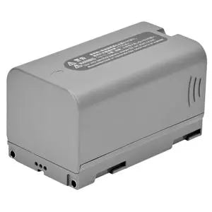
- Smart Li-Ion Battery (p/n: 1083764-01)
- Charger Power Supply with Adapter (p/n: 1083766-01)
- MAGNET Bridge Desktop Additional License (p/n: 1083772-01)
- Collage Web Single User Subscription, 100 GB Storage / Streaming (p/n: 1022937-60)
- Collage Web Single User Renewal, 100 GB Storage / Streaming (p/n: 1022937-61)
Rugged and Portable Field Design
The Topcon CR-S1 is designed for daily professional use. The scanner weighs 2.2 kg (4.85 lb) with the base, battery, and RTK module installed. It includes 512 GB of SSD storage, USB-C connectivity, a lithium-ion battery, and an IP64 protection rating.
The CR-S1 operates from -20°C to 40°C (-4°F to 104°F), making it suitable for demanding field environments where speed, portability, and reliable data capture are critical.
Reliable Data Collection for Modern Projects
The Topcon CR-S1 Professional Handheld 3D Scanner provides surveyors, contractors, engineers, and mapping professionals with a fast, flexible way to capture real site conditions. With SLAM LiDAR scanning, RTK/PPK/GCP support, panoramic imaging, MAGNET Bridge processing, Collage Web sharing, and multiple mounting options, the CR-S1 is built for teams that need accurate 3D data without a complicated setup.
Whether documenting construction progress, measuring stockpiles, mapping utilities, scanning tunnels, or creating accurate site records, the CR-S1 helps users capture the data they need and turn it into actionable deliverables.
Pago y seguridad
Métodos de pago
Su información de pago se procesa de forma segura. No almacenamos los datos de su tarjeta de crédito ni tenemos acceso a la información de su tarjeta de crédito.