Stonex XFLY120 / XFLY300 LiDAR UAV Payload
Stonex XFLY120 / XFLY300 LiDAR UAV Payload - XFLY120 / Annual License (Included) está agotado y se enviará tan pronto como vuelva a estar disponible.
Entrega y Envío
Entrega y Envío
Todos los equipos en stock se enviarán dentro de las 24 horas posteriores a la compra.
Se proporcionará un número de seguimiento de UPS por correo electrónico o mensaje de texto cuando creemos la etiqueta.
Para equipos en espera de entrega, espere de 3 a 5 días adicionales de envío + proceso de calibración.
Speak With An Expert
Speak With An Expert
Igualación de precios
Igualación de precios
¿Encontró un mejor precio?
Envíenos un correo electrónico con un enlace a la lista de distribuidores autorizados y lo igualaremos o lo mejoraremos.
info@aaisurvey.com
Todo el equipo se enviará calibrado.
Los instrumentos ópticos y los láseres rotatorios vienen con una certificación
Descripción
Descripción
Operating Procedure Instructions
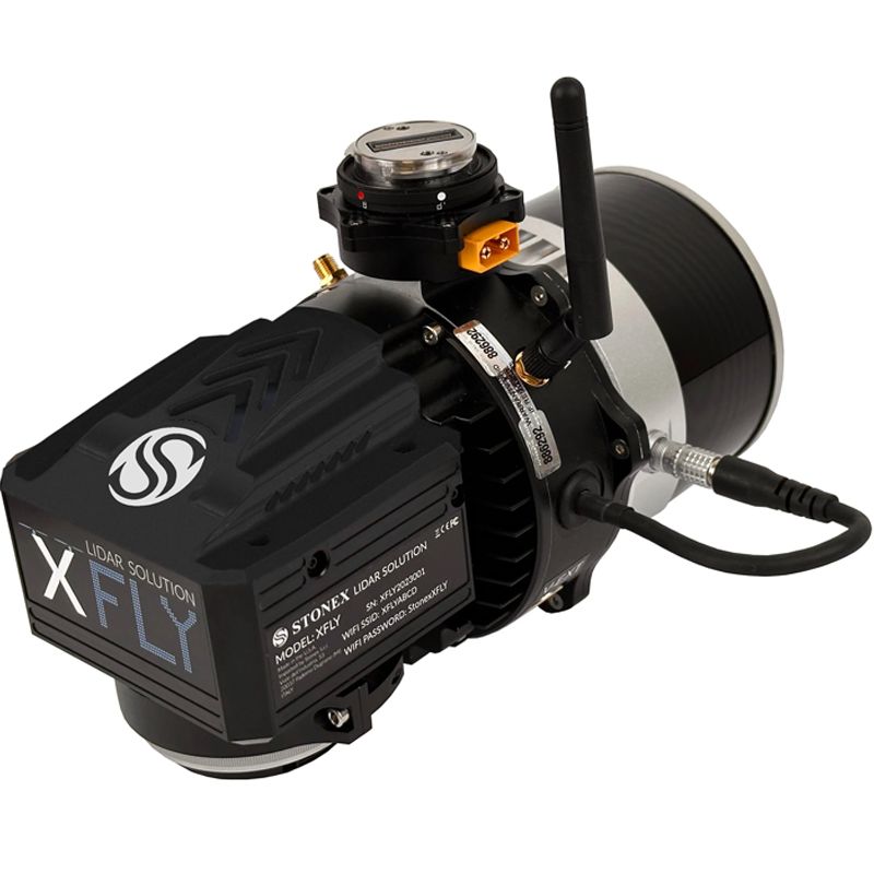
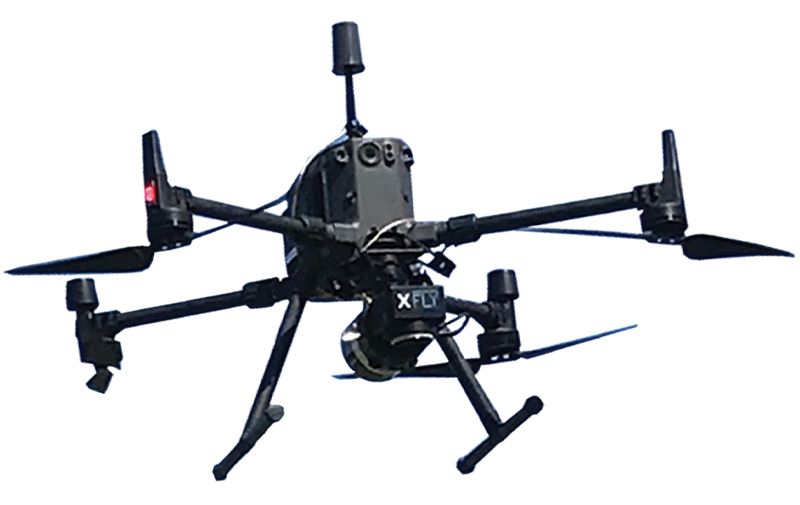
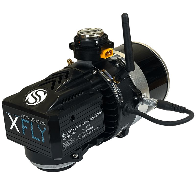
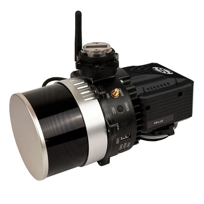
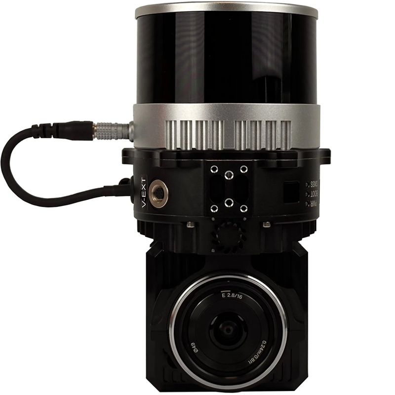
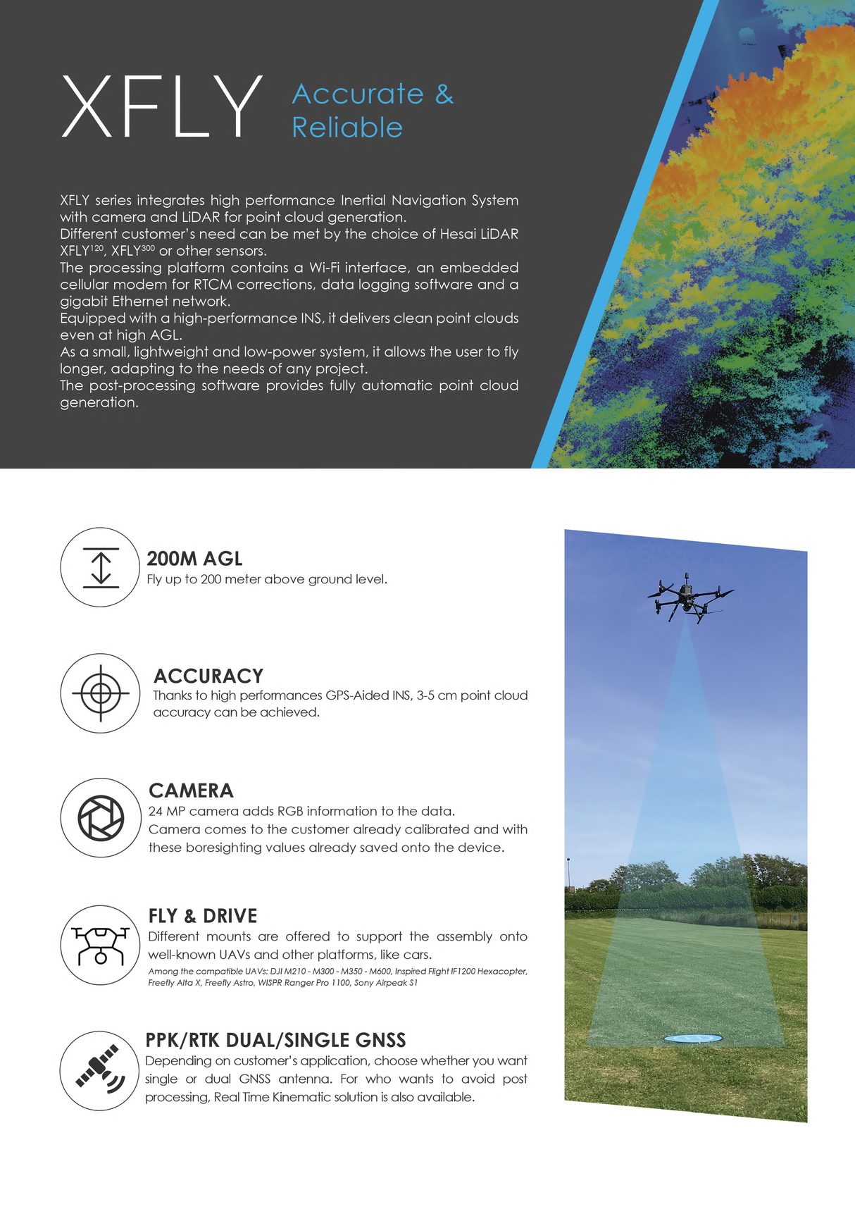
The Stonex XFLY120 and XFLY300 are high-performance LiDAR payloads designed for aerial drone surveys with the DJI M300 and M350. These systems integrate a powerful GPS-aided Inertial Navigation System (INS), LiDAR scanner, and 24MP calibrated RGB camera, providing dense and accurate 3D point cloud data for professional-grade surveying and mapping applications.
Each unit comes complete with an XFLY carrying case, HC977 antenna and mounting kits, power and data cables, USB storage drive, and four DJI-compatible vibration isolators. Included is a one-year license for the XFLYpost software for fully automated georeferencing and point cloud generation.
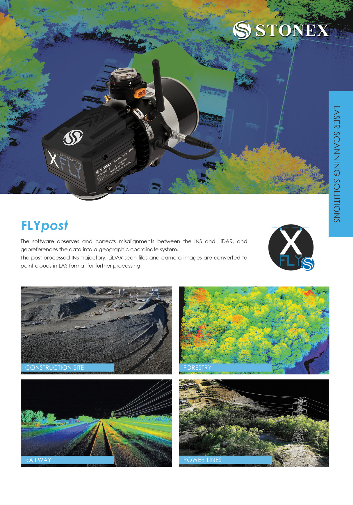
XFLYpost Software
XFLYpost enables seamless post-processing by aligning the INS and LiDAR data, correcting for any drift or misalignment. It georeferences trajectory paths and camera imagery and outputs clean LAS-format point clouds. The software ensures accuracy in complex terrain and is optimized for construction, forestry, railway inspection, and power line mapping.
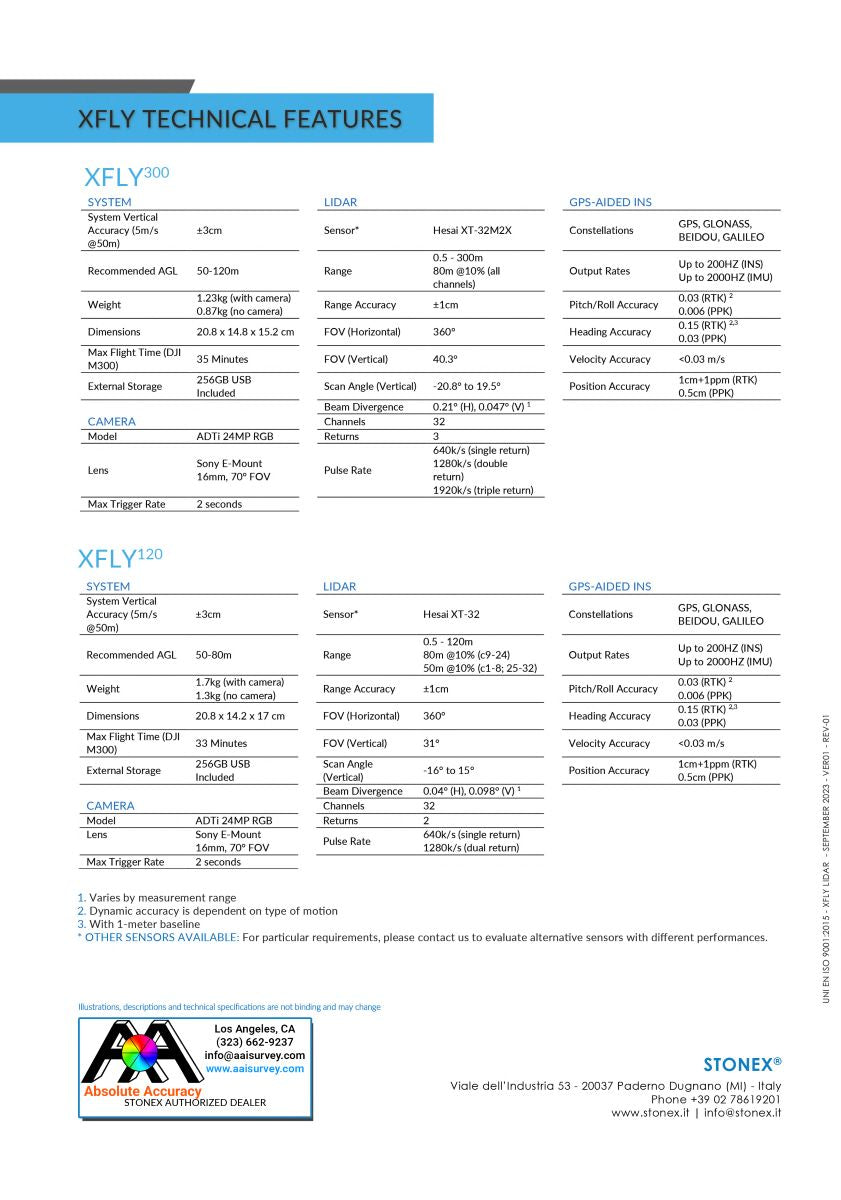
Model Comparison: XFLY120 vs XFLY300
| Feature | XFLY120 | XFLY300 |
|---|---|---|
| LiDAR Sensor | Hesai XT-32 | Hesai XT-32M2X |
| Range | Up to 120m | Up to 300m |
| Returns | 2 | 3 |
| Vertical Scan Angle | -16° to 15° | -20.8° to 19.5° |
| Beam Divergence | 0.04°(H), 0.098°(V) | 0.21°(H), 0.047°(V) |
| Weight w/ Camera | 1.7kg | 1.23kg |
| Flight Time (DJI M300) | 33 minutes | 35 minutes |
| Field of View (Vertical) | 31° | 40.3° |
| Scan Density | Lower pulse rate, dual return | Triple return, higher pulse rate |
| Best For | Mid-range missions, efficient scans | Long-range, dense vegetation, power lines |
Why Choose XFLY300:
For projects requiring long-range scanning, dense vegetation penetration, or increased detail capture, the XFLY300 is the top performer. Its 300m range and triple return capability allow for more comprehensive surface modeling and structural detail.
Why Choose XFLY120:
Ideal for mid-range projects where flight time and payload weight are a concern, the XFLY120 offers strong performance with reduced power consumption and easier handling. It’s a solid choice for general land mapping, forestry, and smaller construction sites.
What’s Included
- XFLY LiDAR Payload (XFLY120 or XFLY300)
- XFLY Rugged Carrying Case
- HC977 GNSS Antenna
- SMA Antenna Cable (1m)
- Antenna Mounting Assemblies
- XFLY Power Cable
- XFLY Data/Control Cable & Connectors
- 256GB USB Storage Drive
- DJI M300/M350 Vibration Isolators (Set of 4)
- XFLYpost Software – 1-Year License
Pago y seguridad
Métodos de pago
Su información de pago se procesa de forma segura. No almacenamos los datos de su tarjeta de crédito ni tenemos acceso a la información de su tarjeta de crédito.
